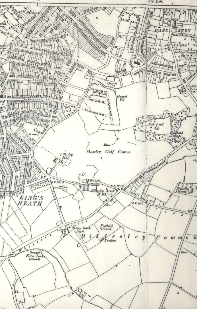
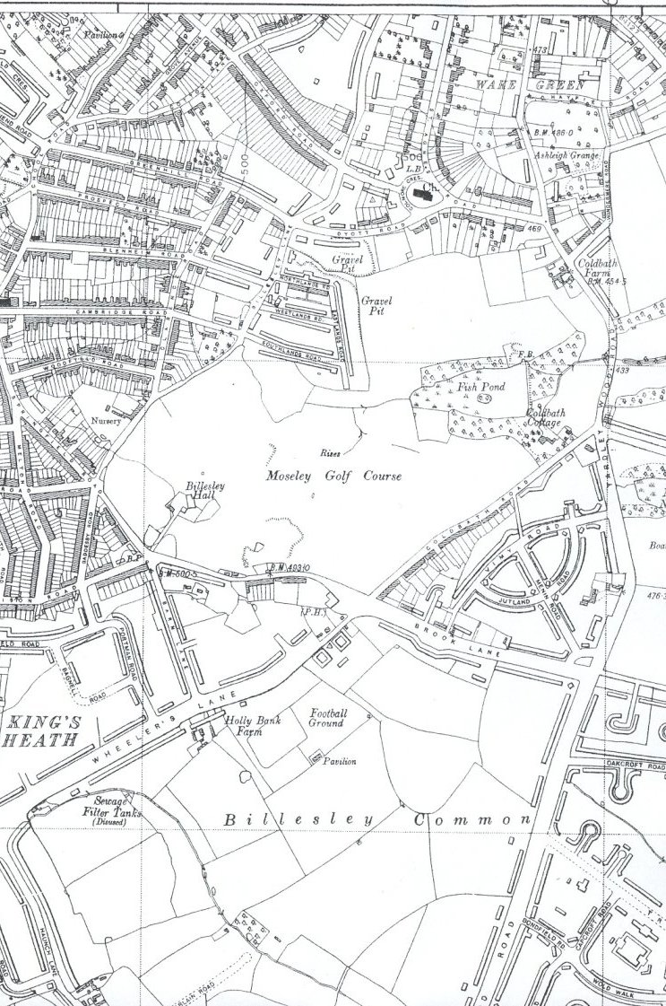
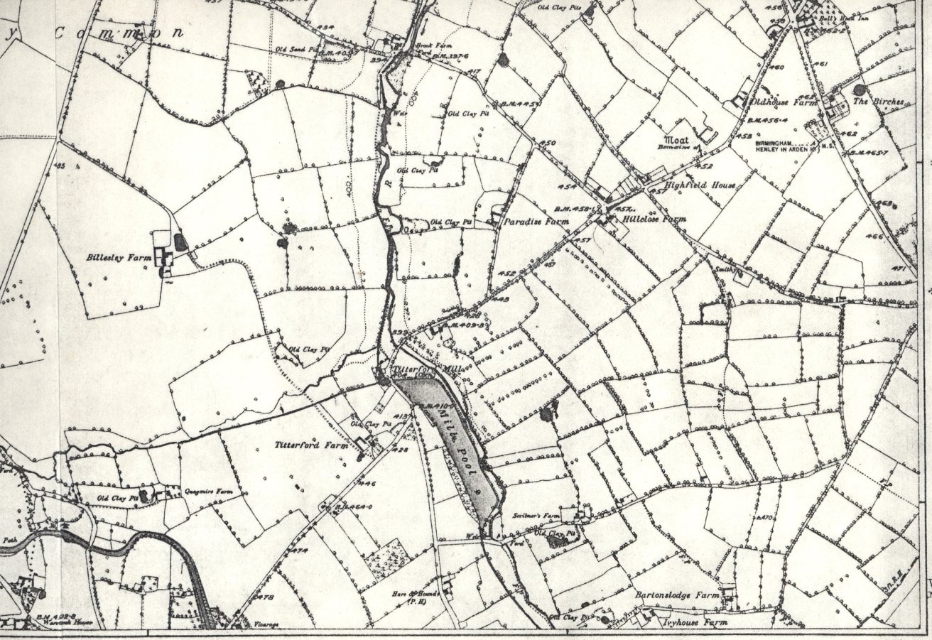
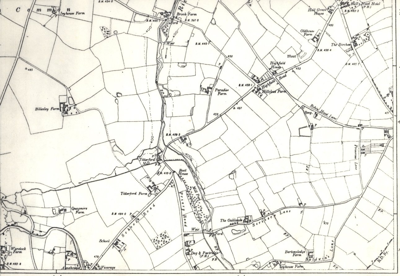
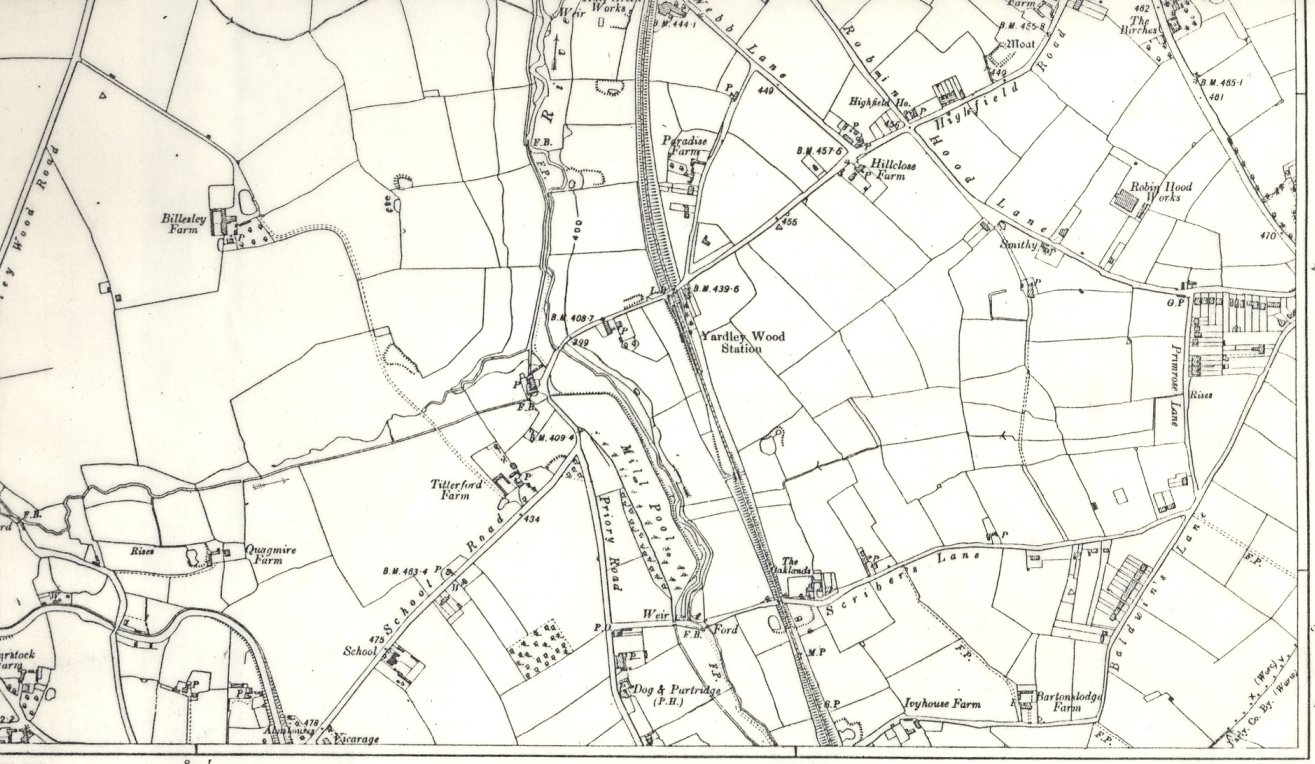
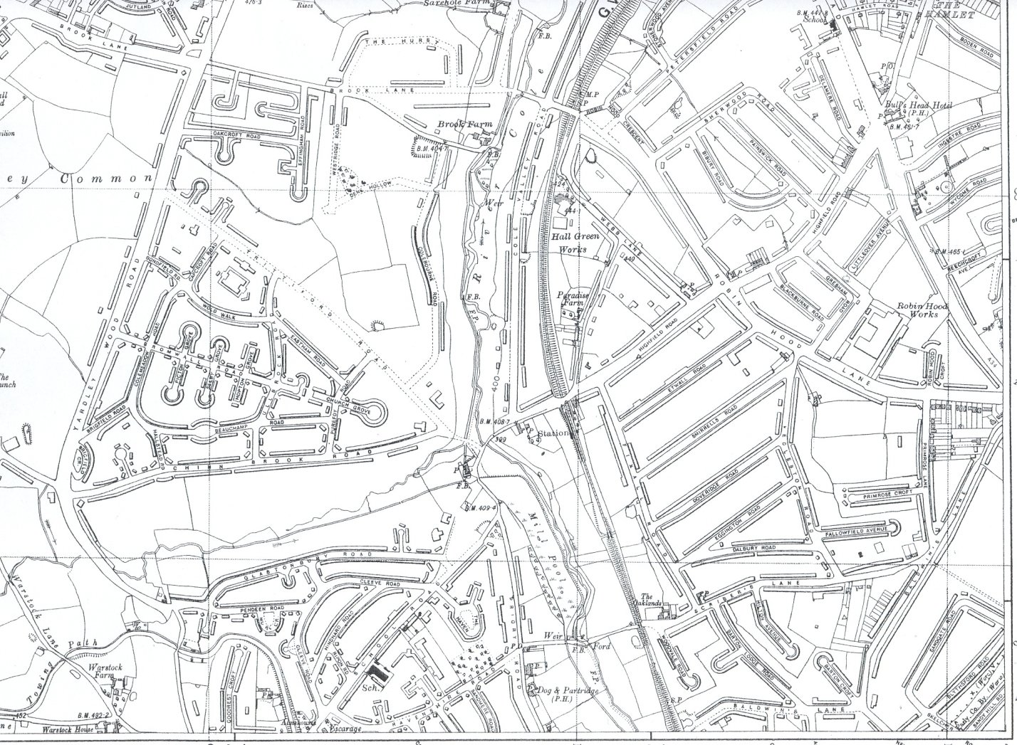
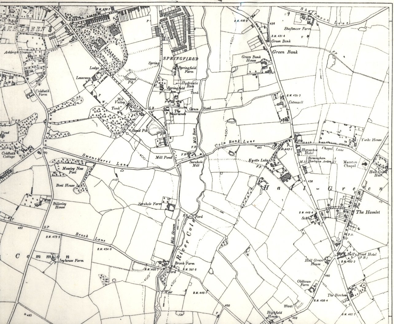
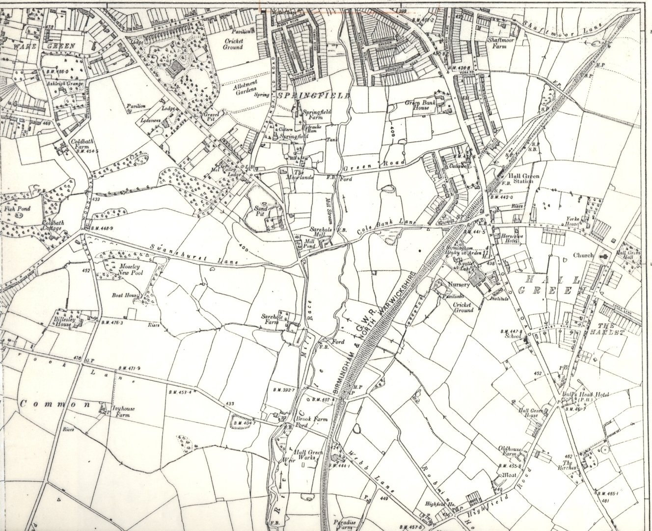
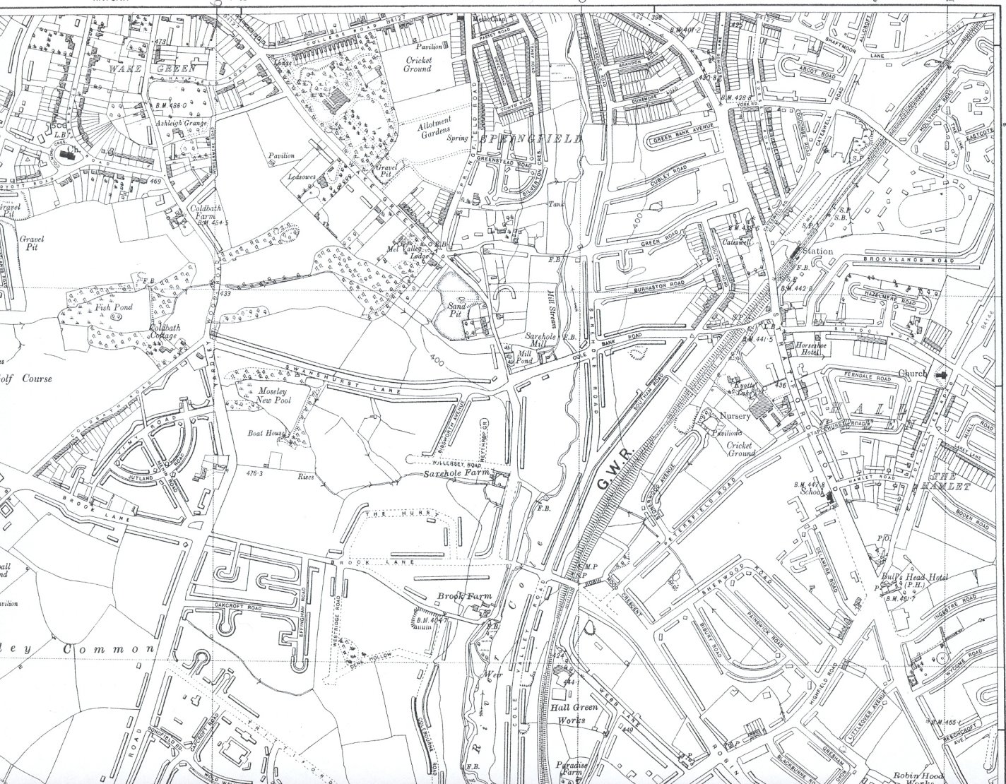
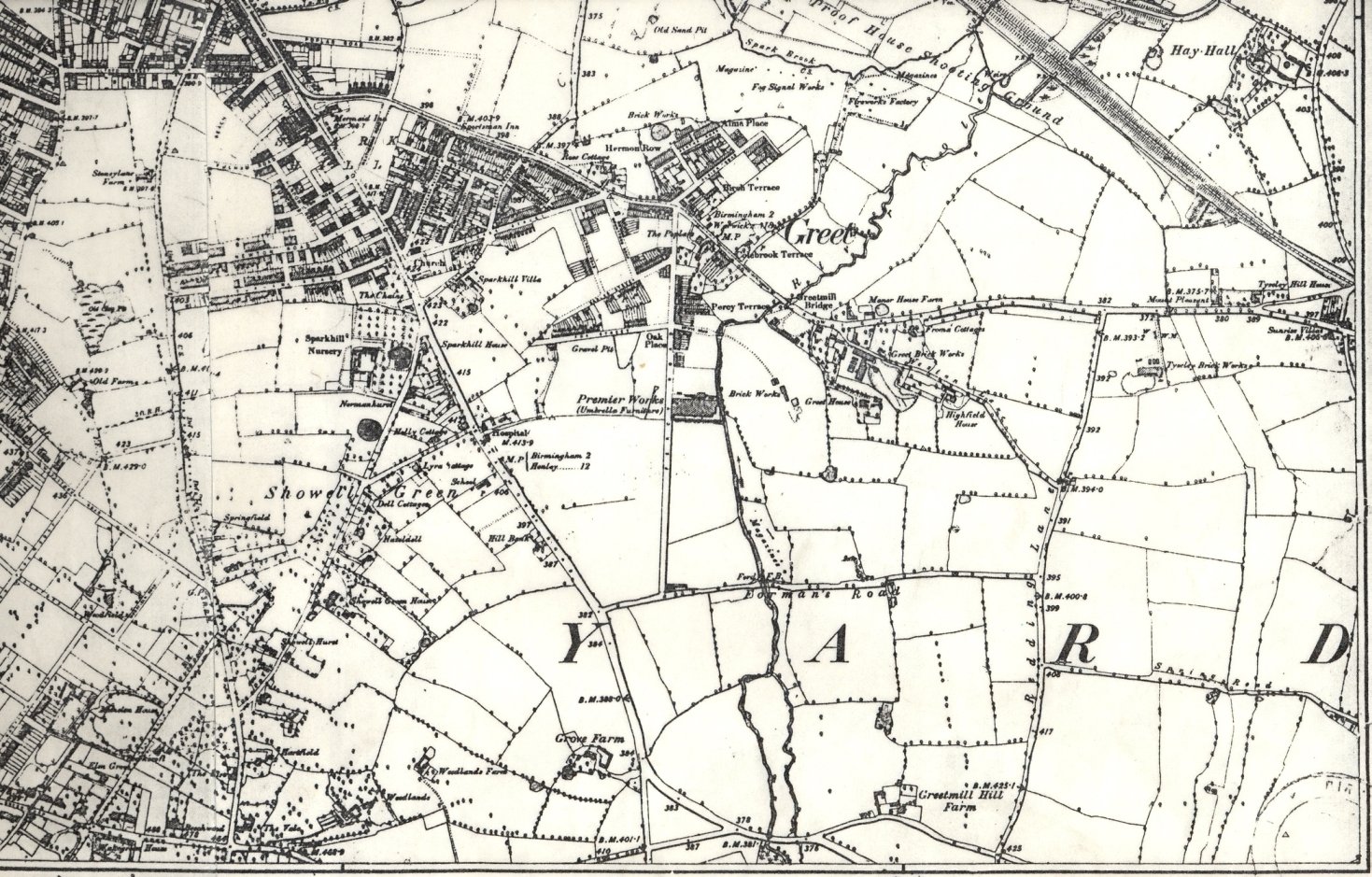
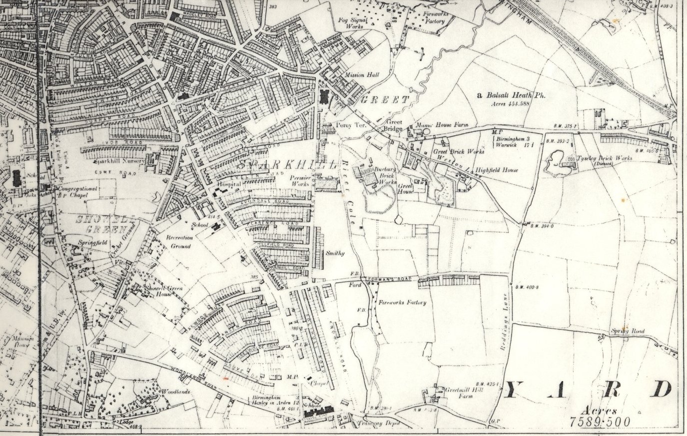
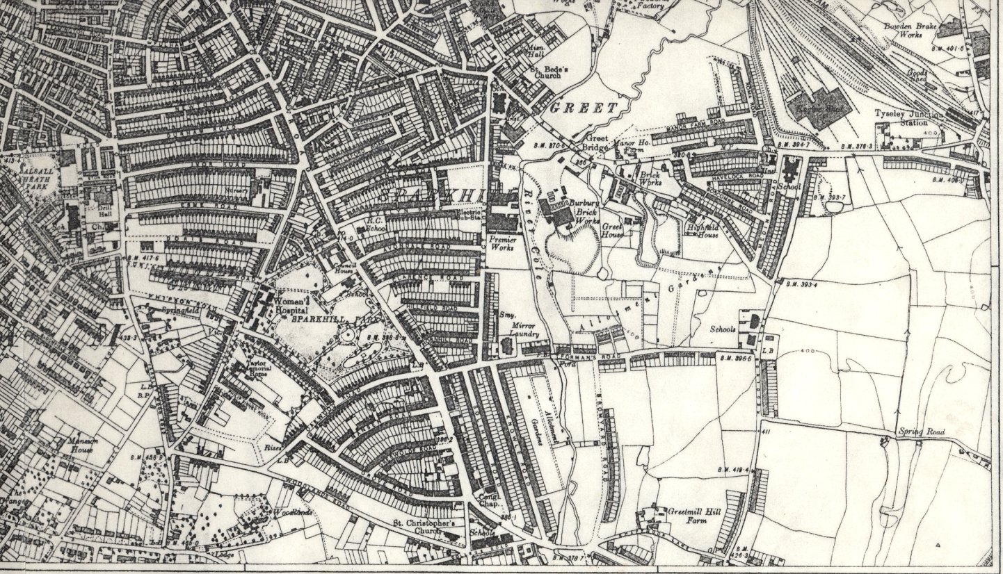
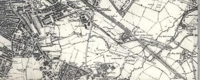
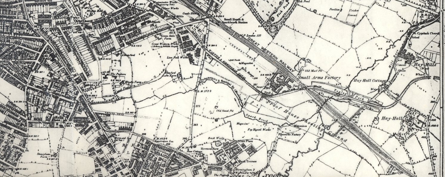
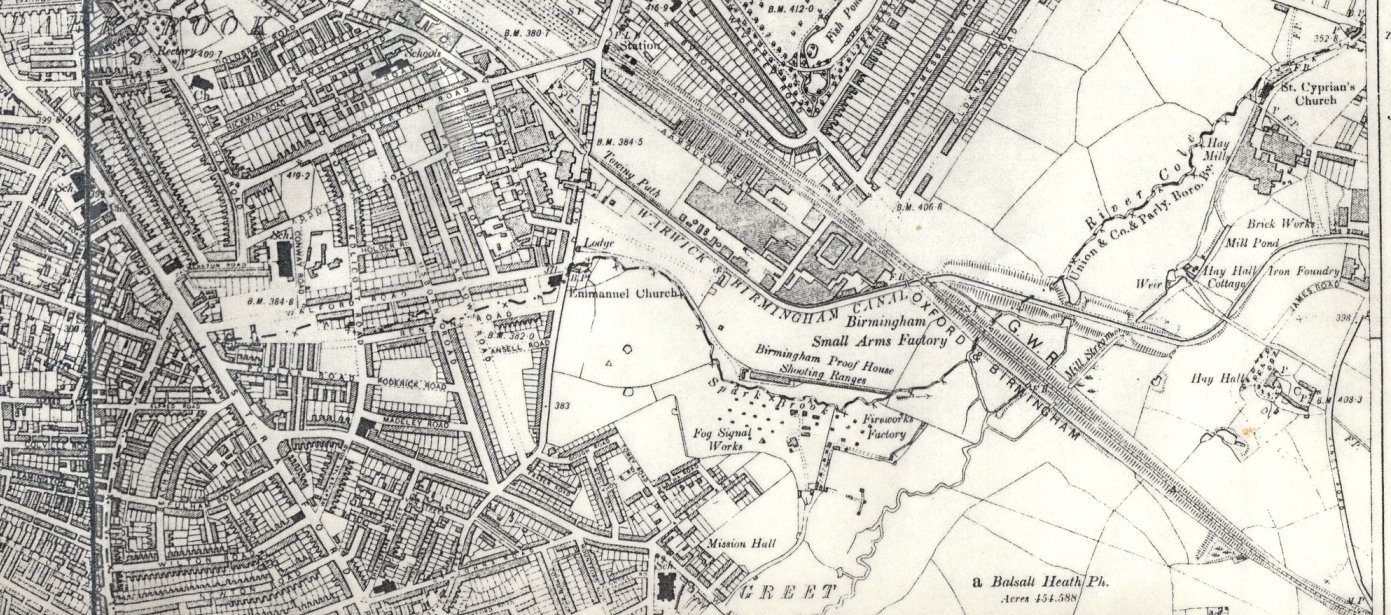
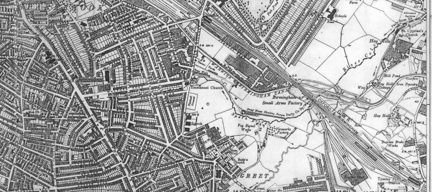
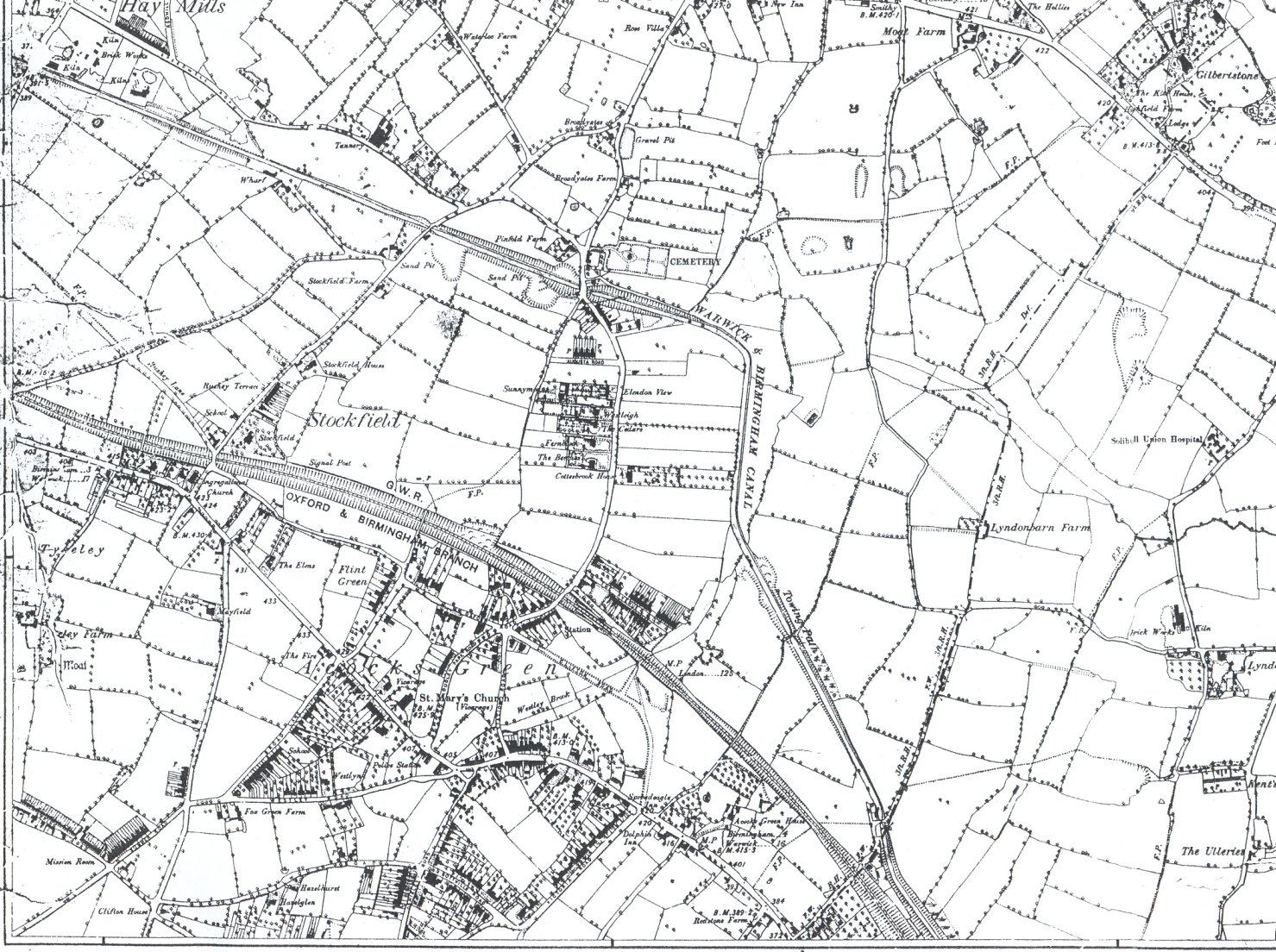
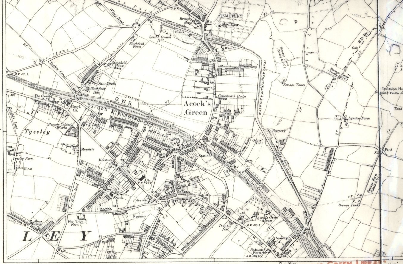
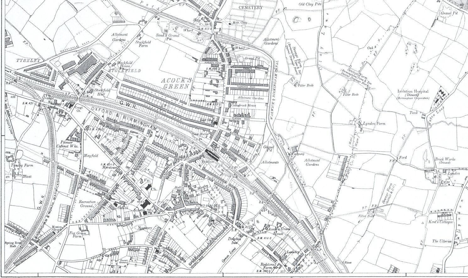
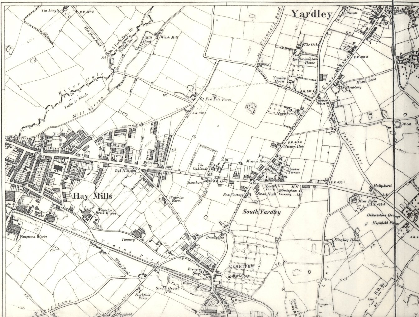
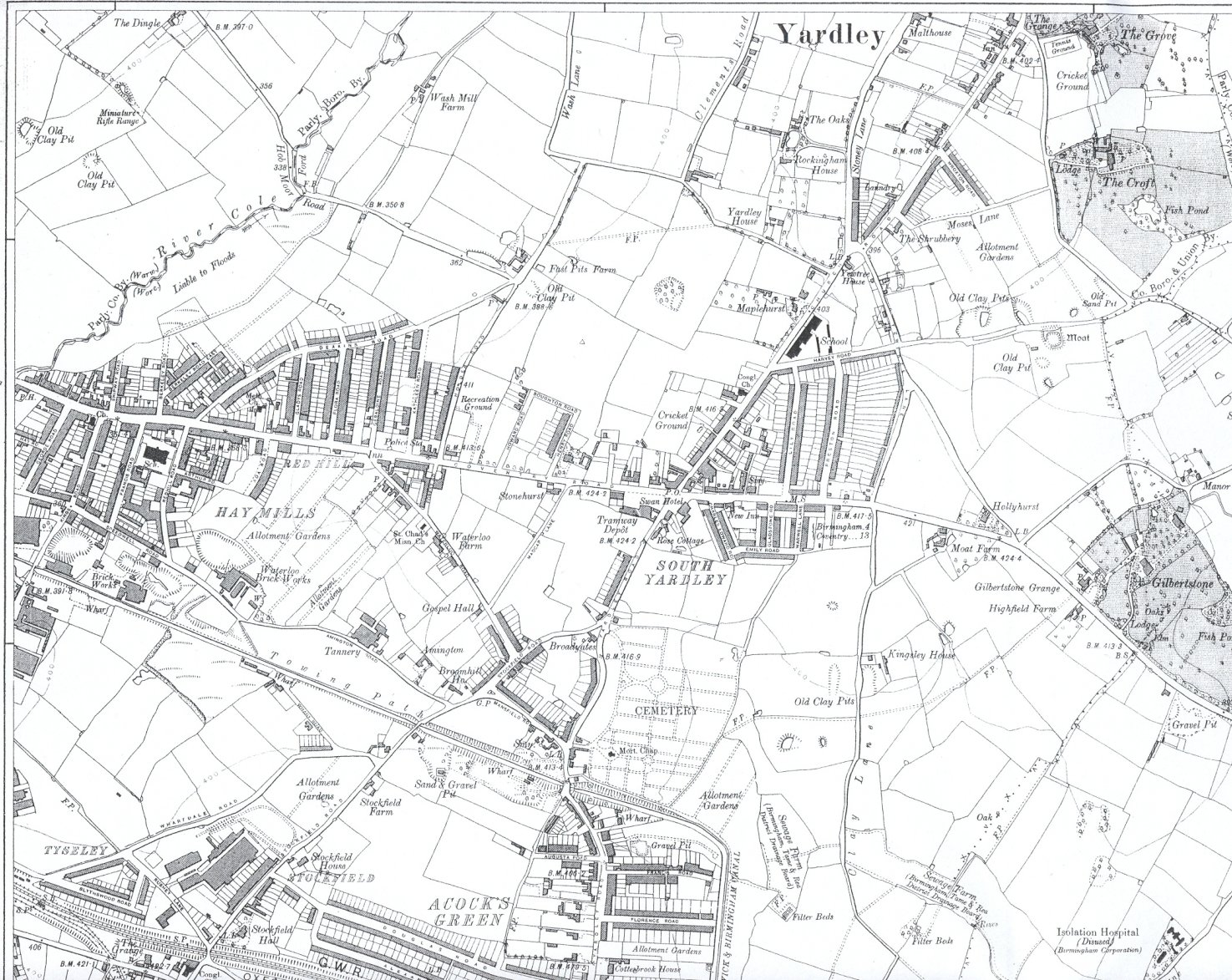
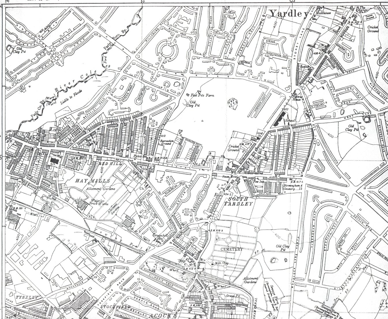
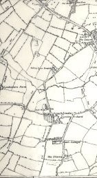
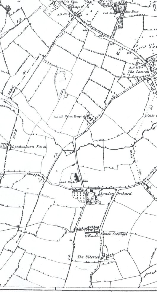
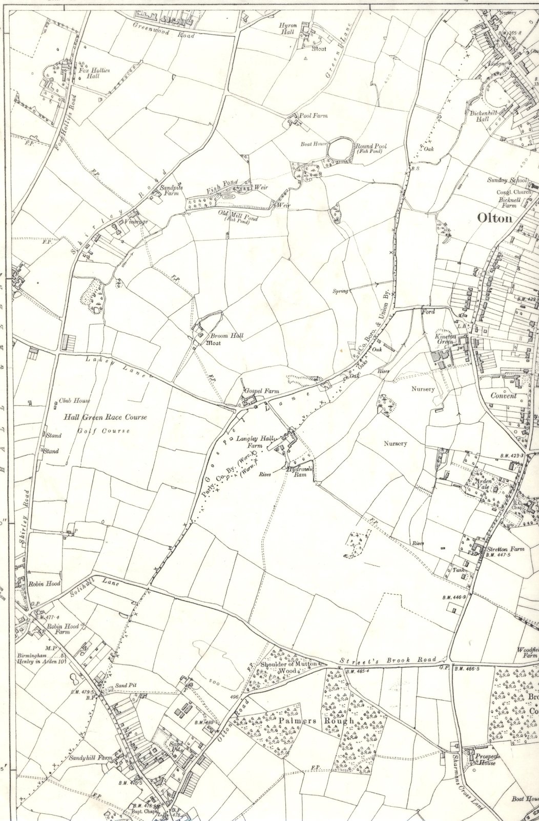
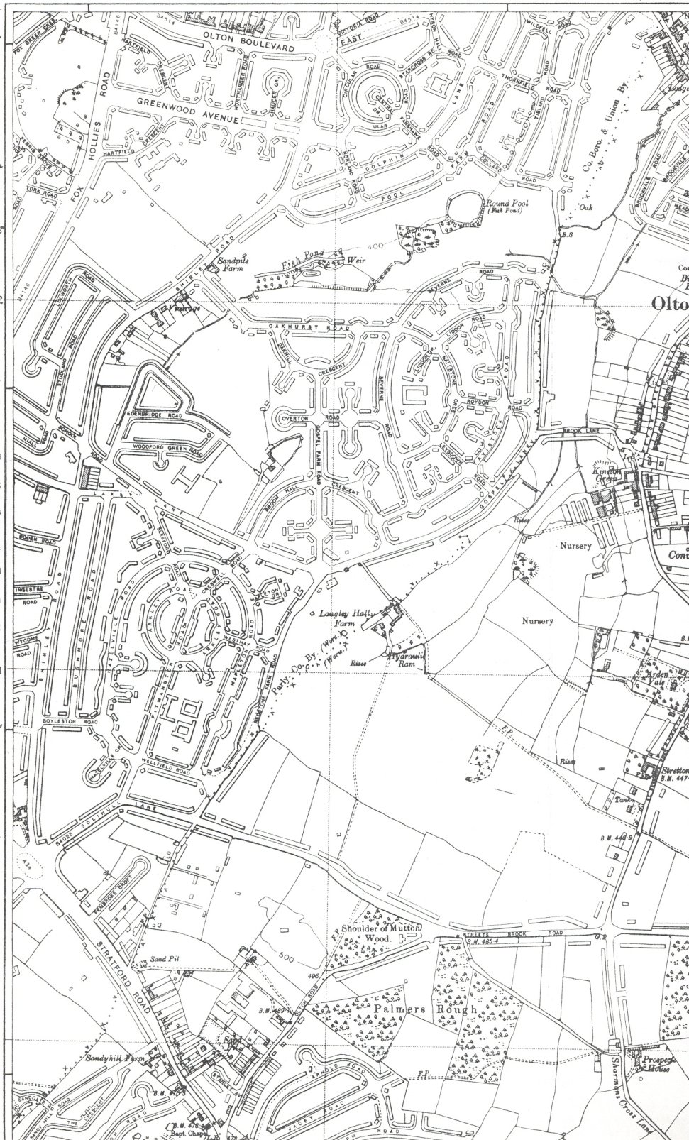
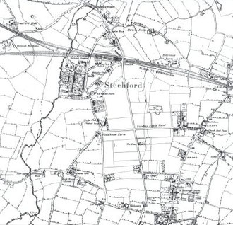
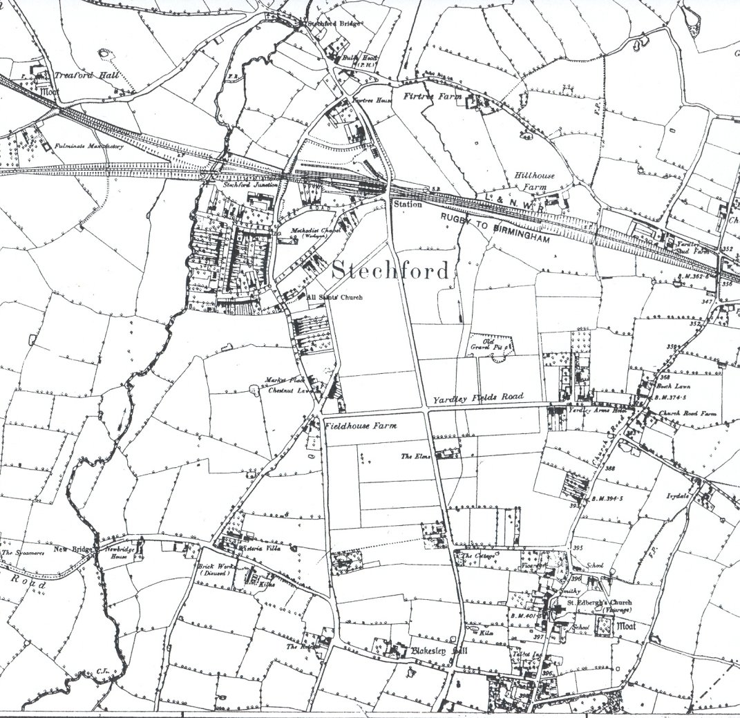
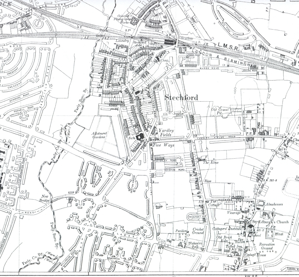
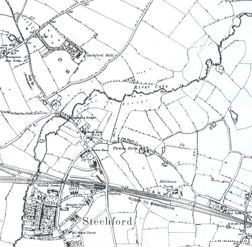
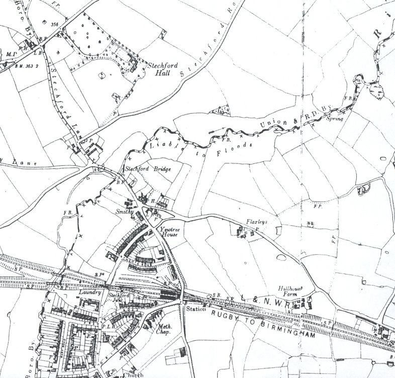
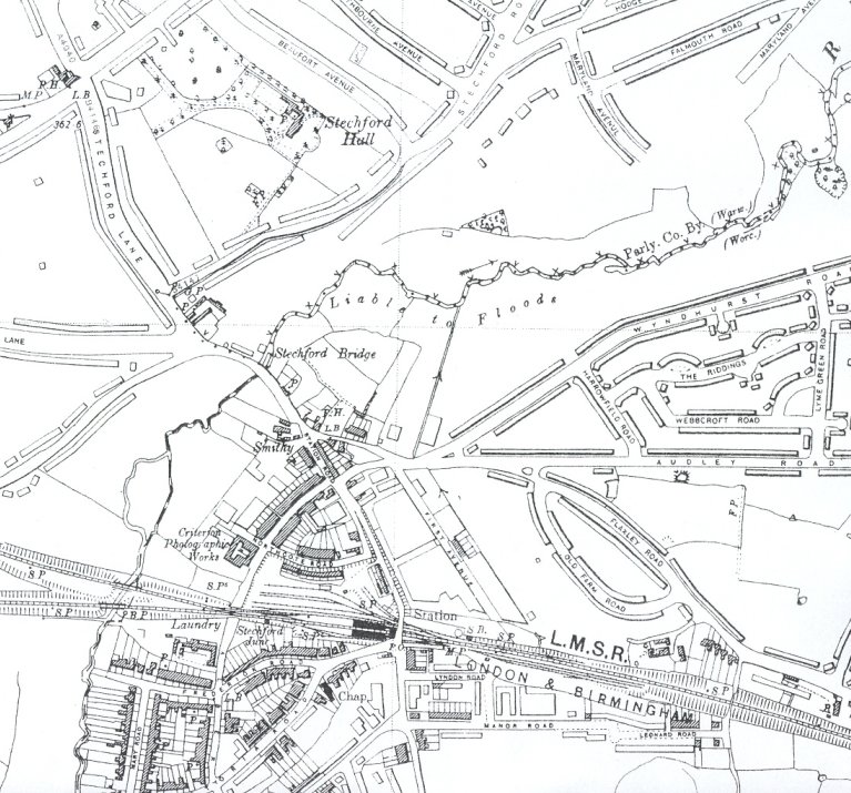
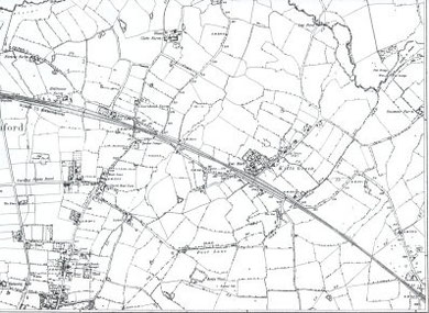
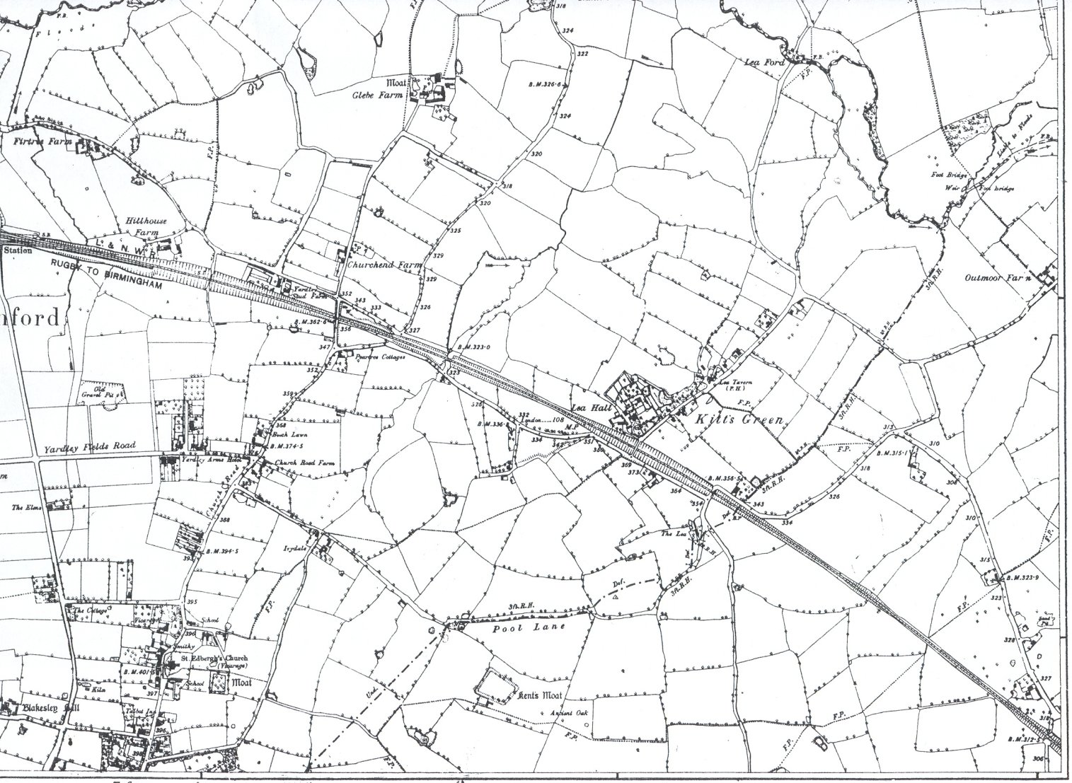
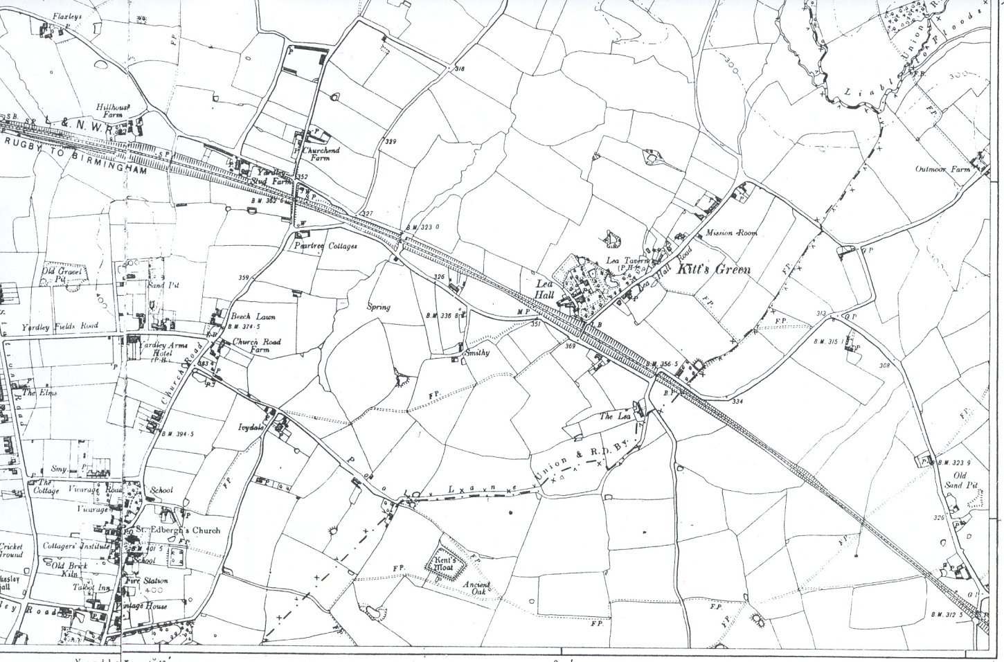
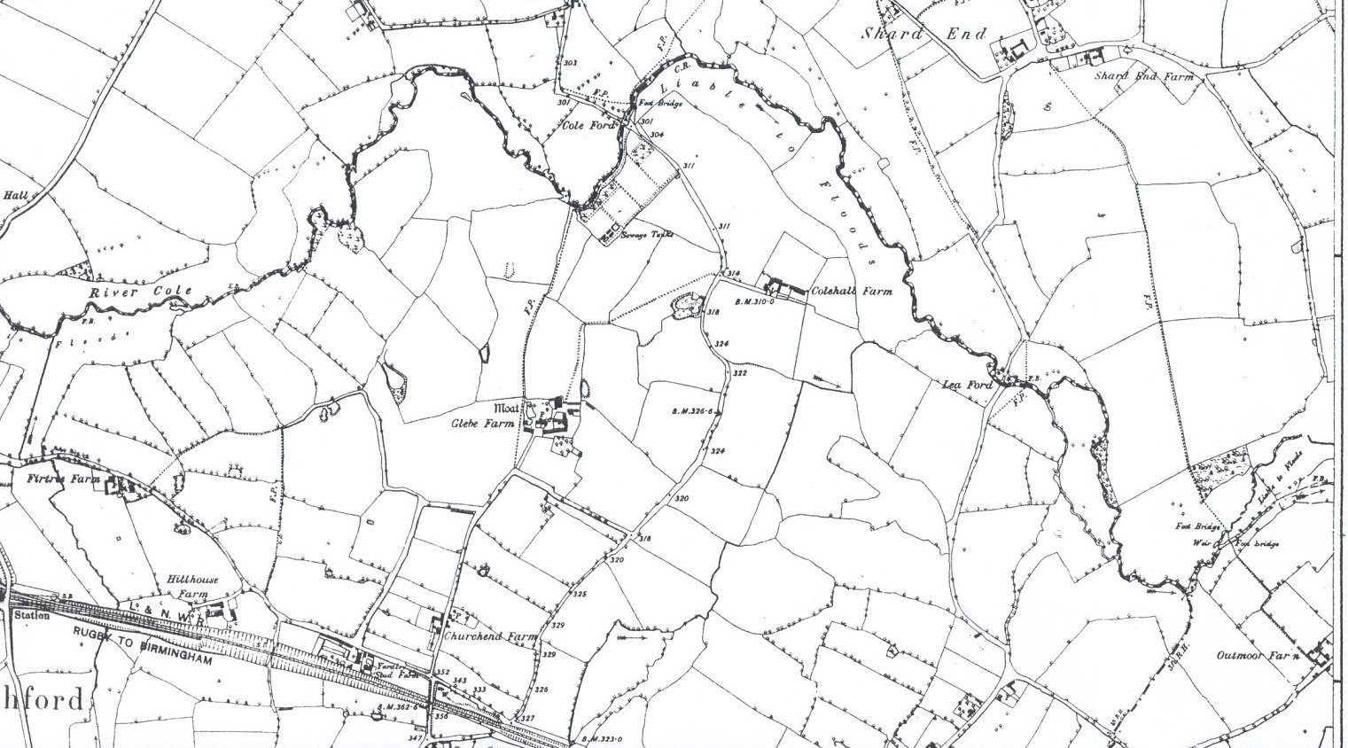
Maps of Yardley Parish


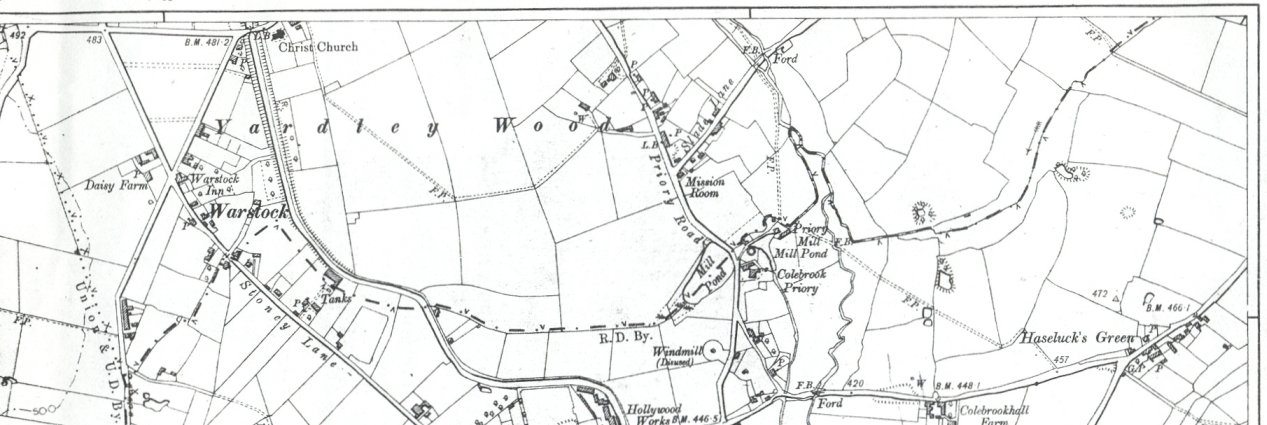
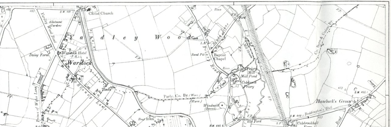
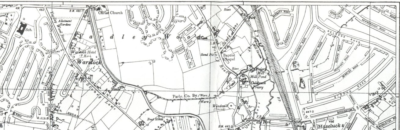
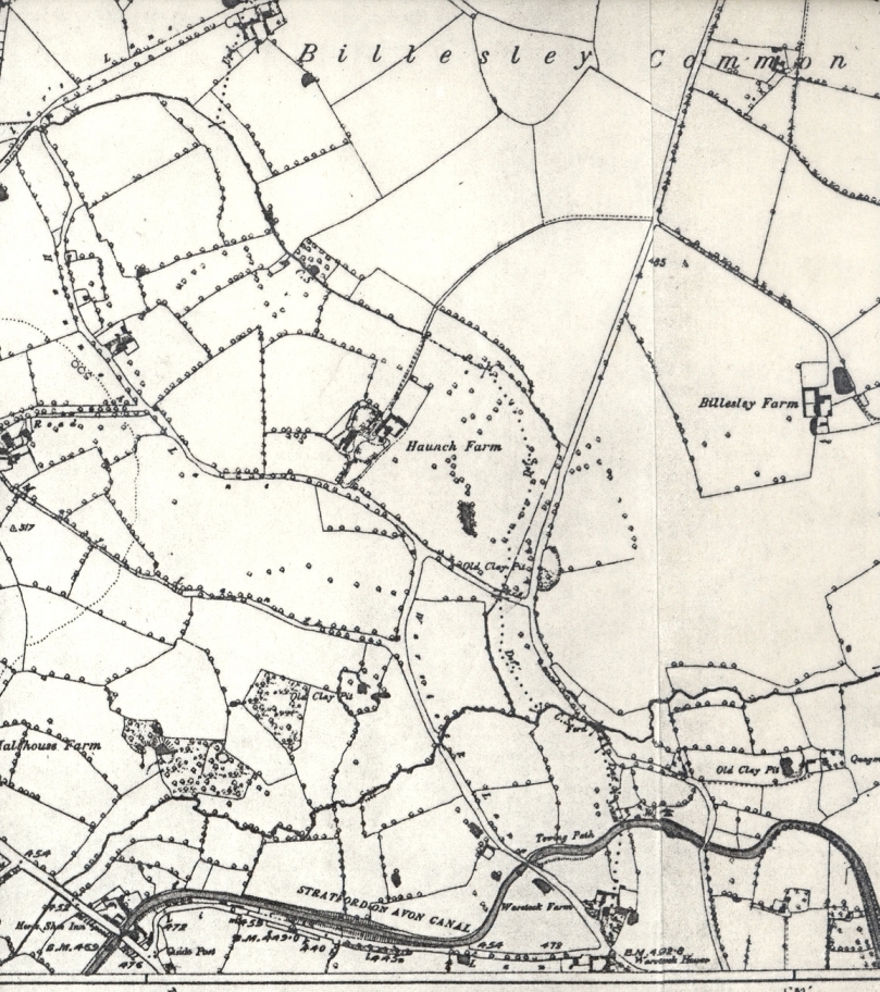
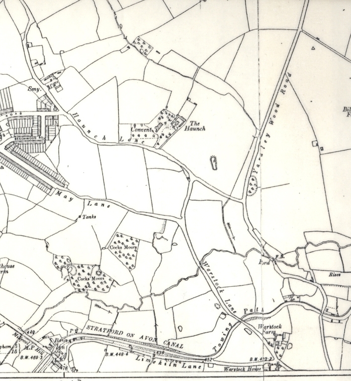
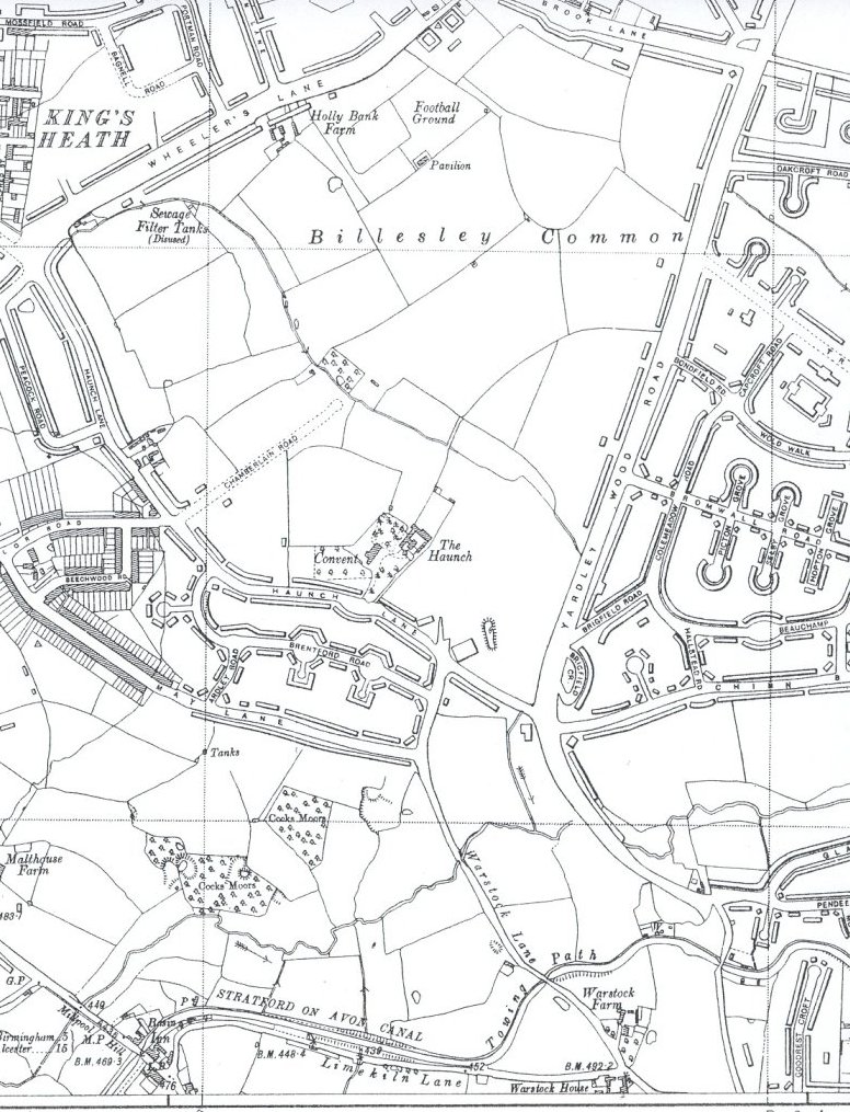
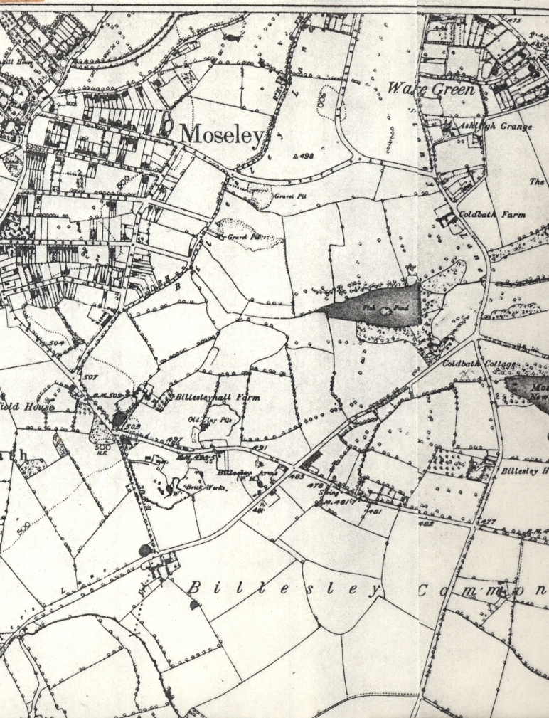
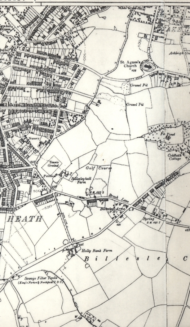
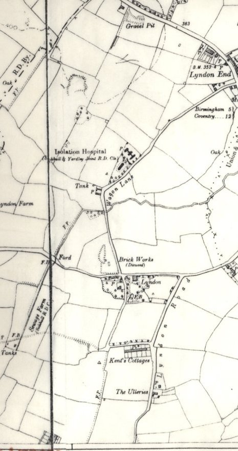
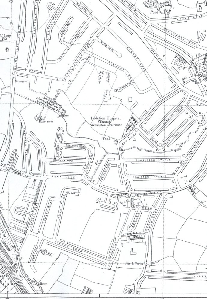
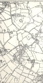
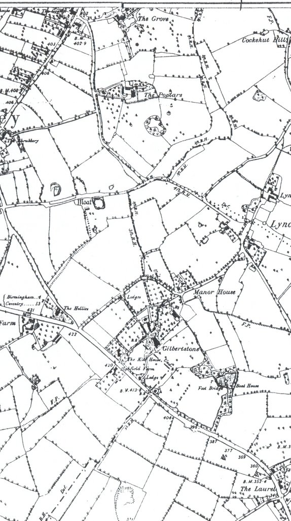
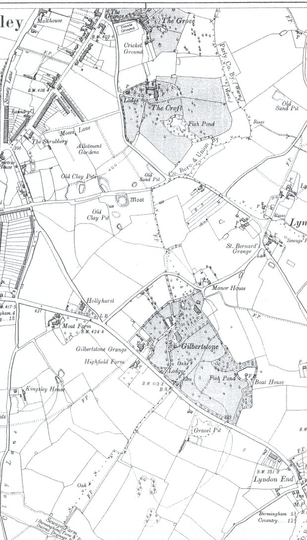
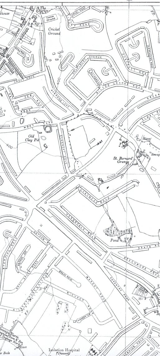
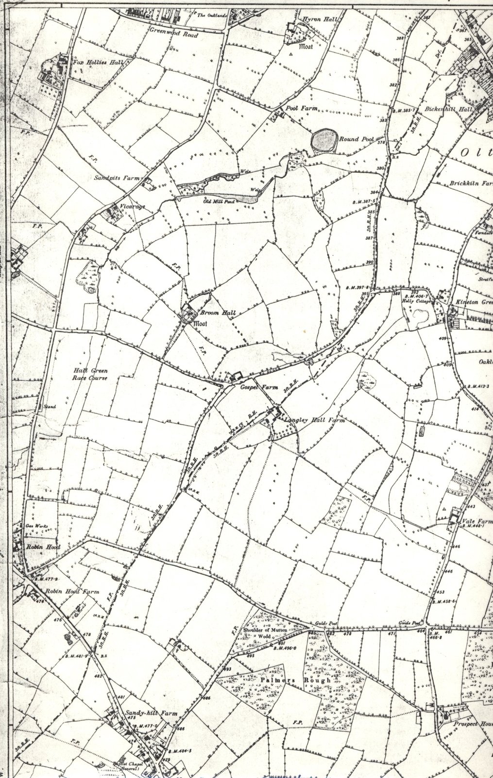
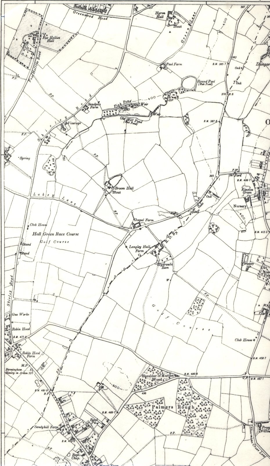
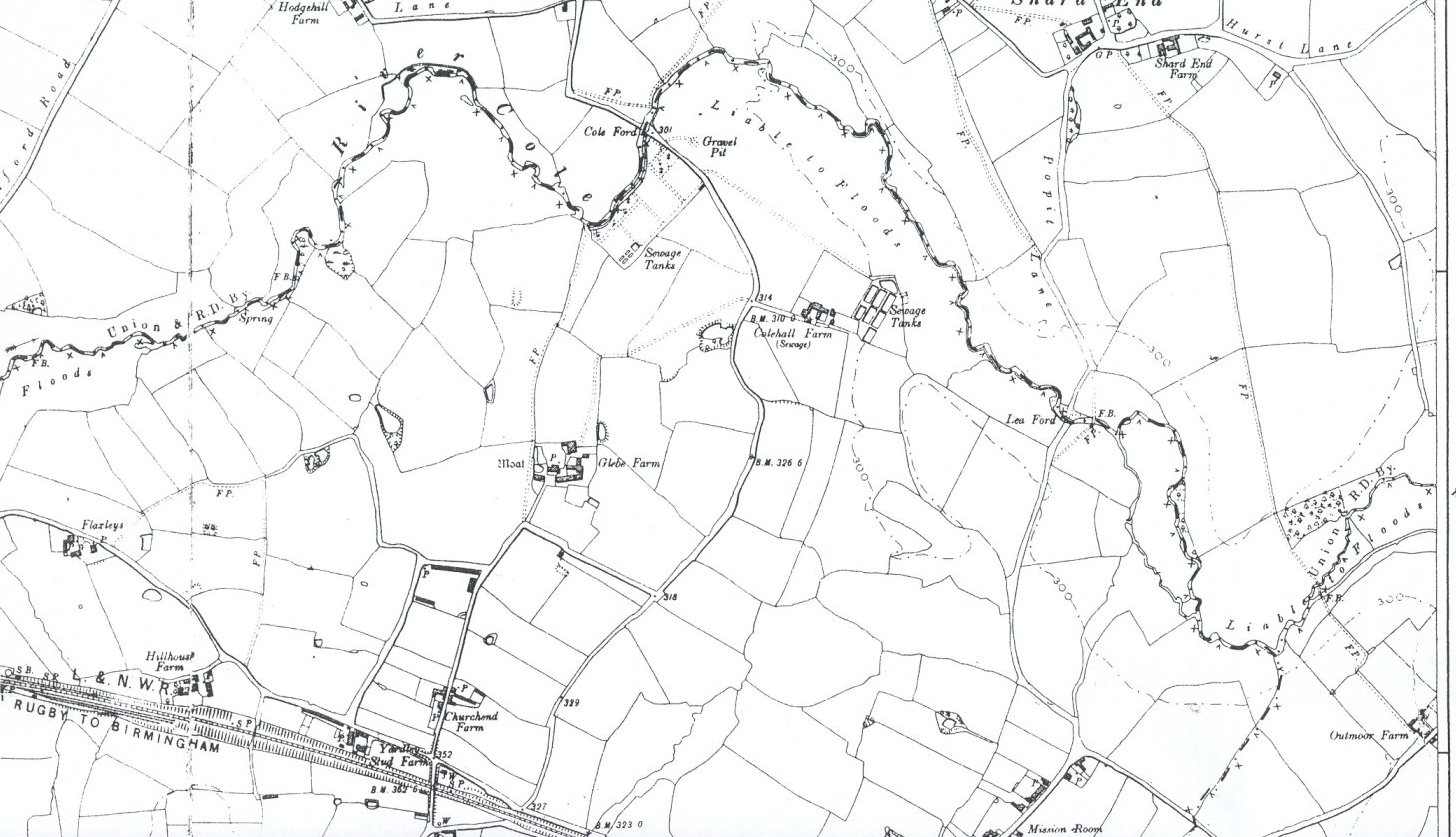
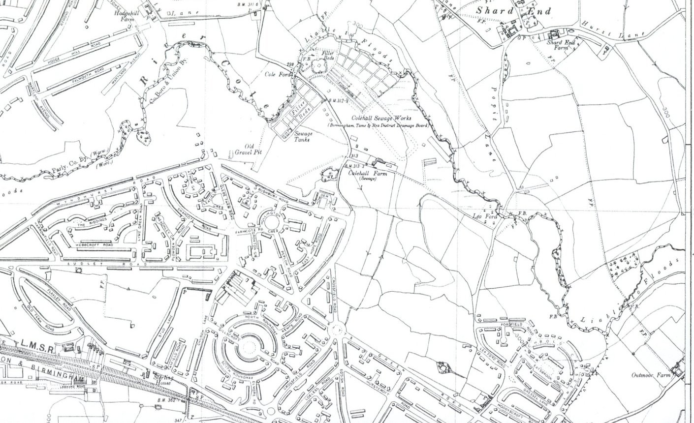
These maps are extracts from the out of copyright Ordnance Survey six inch to one mile county series from 1886 to 1938. The 1930s edition was a provisional or emergency edition produced before the war, so the drawing of the inter-war estates was sketchy: however this makes them easier to identify. We have not been able to find a full set of maps for north Yardley, but the 1920s state can be deduced by subtracting the sketched in areas from the 1938 edition. After Yardley was absorbed into Birmingham in 1911, some of the boundaries were no longer visible on maps.

Some of these files are large, and may take some time to load. If they still appear to be small, wait a few seconds, then click on the icon that appears at the bottom right of the images. The maps are low resolution, and are not designed for printing but for viewing on screen.


Alan Godfrey Maps sells excellent scaled down reproductions of 25 inches to one mile maps from the early years of the twentieth century. These also have useful historical information on the back. Old Maps sells copies of many editions of the maps at both 6 inches and 25 inches to the mile. The maps can be seen online, including the missing 1920 map below. Birmingham Libraries are able to supply quality reproductions of some historical maps in their collection.


The City Council now makes available large scale up to date maps for private use. Go to www.birmingham.gov.uk/maps, then click on View Interactive Maps, partially zoom in then use the Pan tool to find the area you want to look at, then zoom all the way in. Individual houses and plots can be identified.


It is possible to study the changes over the half century covered by the maps by overlaying them on screen. If you download them to your computer, right click on the file, and choose to open with Internet Explorer, you can open each one in a new window, and the area of interest can be lined up on the maps by using the title bars and scroll bars of the windows until the area is at the same position on screen on each map. Using the taskbar to switch between maps then gives the opportunity of seeing at a glance the sequence of development.


Yardley Wood
Yardley Wood
yardleywood1886a.jpg
JPG Image 134.2 KB
yardleywood1905a.jpg
JPG Image 115.3 KB
yardleywood1920a.jpg
JPG Image 111.4 KB
yardleywood1938aa.jpg
JPG Image 169.9 KB
Billesley, Yardley Wood
hallgreen1887baa.jpg
JPG Image 608.2 KB
hallgreen1905baa.jpg
JPG Image 421.0 KB
hallgreen1919baa.jpg
JPG Image 361.3 KB
hallgreen1938b.jpg
JPG Image 216.1 KB
Billesley, Wake Green
hallgreen1887aaa.jpg
JPG Image 685.7 KB
hallgreen1905aaa.jpg
JPG Image 545.4 KB
hallgreen1919aaa.jpg
JPG Image 211.3 KB
hallgreen1938a.jpg
JPG Image 258.7 KB
Billesley, Hall Green, Yardley Wood
hallgreen1887da.jpg
JPG Image 324.4 KB
hallgreen1905daa.jpg
JPG Image 236.0 KB
hallgreen1919daa.jpg
JPG Image 214.6 KB
hallgreen1938da.jpg
JPG Image 441.4 KB
Billesley, Hall Green, Wake Green
hallgreen1887ca.jpg
JPG Image 395.8 KB
hallgreen1905caa.jpg
JPG Image 327.3 KB
hallgreen1919caa.jpg
JPG Image 380.2 KB
hallgreen1938ca.jpg
JPG Image 498.8 KB
Greet, Showell Green, Sparkhill
sparkhill1889ba.jpg
JPG Image 403.4 KB
sparkhill1905ba.jpg
JPG Image 358.4 KB
sparkhill1921ba.jpg
JPG Image 443.2 KB
sparkhill1938baa.jpg
JPG Image 494.0 KB
Sparkhill, Tyseley
Sparkhill, Tyseley
sparkhill1889aaa.jpg
JPG Image 309.6 KB
sparkhill1905aaa.jpg
JPG Image 321.2 KB
sparkhill1921aaa.jpg
JPG Image 392.2 KB
sparkhill1938aa.jpg
JPG Image 376.9 KB
Acocks Green, South Yardley
yrdley1887ba.jpg
JPG Image 474.4 KB
yardley1905ba.jpg
JPG Image 331.2 KB
yrdley1920ba.jpg
JPG Image 402.4 KB
yardley1938baa.jpg
JPG Image 511.9 KB
Hay Mills, South Yardley, Yardley
yrdley1887aa.jpg
JPG Image 418.3 KB
yardley1905aa.jpg
JPG Image 354.0 KB
yrdley1920aa.jpg
JPG Image 488.7 KB
yardley1938aa.jpg
JPG Image 508.1 KB
Lyndon, South Yardley
yrdley1887da.jpg
JPG Image 112.2 KB
yardley1905db.jpg
JPG Image 78.4 KB
yardley1920db.jpg
JPG Image 121.3 KB
yrdley1938da.jpg
JPG Image 188.7 KB
Lyndon, South Yardley, Yardley
yrdley1887ca.jpg
JPG Image 156.7 KB
yardley1905c.jpg
JPG Image 135.6 KB
yrdley1920ca.jpg
JPG Image 171.9 KB
yrdley1938ca.jpg
JPG Image 167.9 KB
Fox Hollies, Hall Green
foxhollies1886a.jpg
JPG Image 410.7 KB
foxhollies1905a.jpg
JPG Image 312.6 KB
foxhollies1920a.jpg
JPG Image 340.1 KB
foxhollies1938a.jpg
JPG Image 447.1 KB
Stechford, Yardley
Stechford, Yardley
stechford1887ba.jpg
JPG Image 275.9 KB
stechford1905baa.jpg
JPG Image 224.0 KB


Stechford 1921


For this map go to the National Library of Scotland website

stechford1938baa.jpg
JPG Image 677.1 KB
Glebe Farm, Stechford
stechford1887aaa.jpg
JPG Image 178.5 KB
stechford1905aaa.jpg
JPG Image 137.4 KB

Stechford 1921


For this map go to the National Library of Scotland website


stechford1938aaa.jpg
JPG Image 154.0 KB
Glebe Farm, Kitts Green Lea Hall, Stechford, Yardley
stechford1887da.jpg
JPG Image 367.8 KB
stechford1905da.jpg
JPG Image 290.3 KB

Stechford 1921


For this map go to the National Library of Scotland website


stechford1938da.jpg
JPG Image 327.3 KB
Glebe Farm, Stechford
stechford1887c.jpg
JPG Image 257.4 KB
stechford1905c.jpg
JPG Image 229.6 KB

Stechford 1921


For this map go to the National Library of Scotland website


stechford1938cb.jpg
JPG Image 267.8 KB