 Acocks Green History Society
Roberts Road
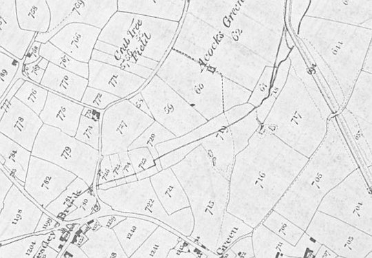
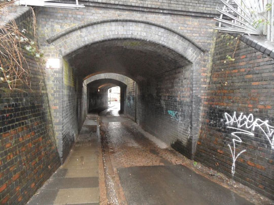
Roberts Road exists because of the Westley Brook. When the railway was being constructed through Acocks Green, a gap had to be made in the embankment to accommodate the brook. It is possible that some foot access for farmers who needed to work fields on both sides was also required. The 1880s O.S. map below shows that by the time Oxford Road (then known as Clifton Road) was being planned, a short road under the bridge to The Avenue was being laid out. By that time The Avenue was built up as far as the bridge anyway. The brook is shown as still open north of the railway within the line of the embankment. The Westley Brook still runs under businesses east of Station Road and under Oxford Road. However modern maps show an open course running for a short distance along the northern part of the embankment just up from the bridge. Whether this is represents a re-routing of the brook from Oxford Road or is just the name for a bit of local drainage is not known at present.
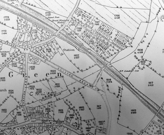
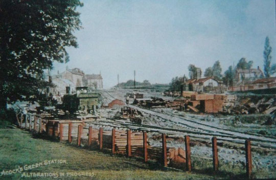
By the 1904 map, nearly all the terrace row on the south side of Roberts Road was present, with the brook now culverted under the pavement in front of the houses. A couple of years later, Oxford Road's houses began to appear, resulting in the culverting of the brook under their houses and gardens. Also the doubling of the railway lines through Acocks Green at the same time resulted in the embankment being widened on its south side and a second bridge being built to take the new lines. This is why there is a gap in the bridges in the middle of the embankment. On the 1916 map shown below the brook appears to be culverted across the entrance to the Sherbourne Nursery, which by then occupied the land between the railway embankment and the back gardens on Oxford Road.
The initial numbering of the terrace row was of odd and even numbers 1 to 11, starting at the embankment and ending at The Avenue. However, in 1931 a set of three pairs of municipal houses was added on the north side of Roberts Road. This was part of the municipal housing then being built going down the hill on The Avenue. This resulting in not only a re-numbering of the terraces but a reversal of the numbers in the row, which were now number 2 onwards starting one house down from The Avenue. The end house of the row became number 54 on the latter road! The municipal houses are odd numbers 1 to 11. We are informed that they are now in private hands. In their own way, they have distinctive architectural qualities, reflecting the Corporation's use of design elements in all of its pre-war suburban housing developments.
The lines added at Acocks Green in 1906-7 were removed in 1968. Eventually the slope up the embankment from Roberts Road was used for access to limited car parking. Availability of parking was such a problem by 2006 that the railway was trying to buy back the land behind Oxford Road that it had sold in the 1970s to the Acocks Green and District Allotment Holders Club and Institute, the Pickle Club's parent body. In the end, extra parking was brought forward by two years and provided in the spring of 2006 along the line of the tracks which had been removed. Parking spaces extend to the bridge.
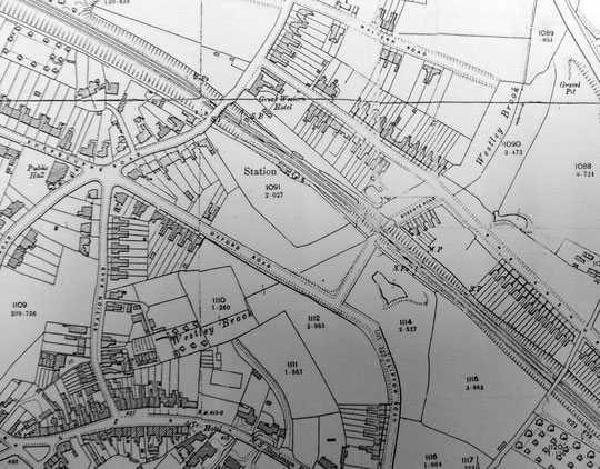
The Warwickshire Railways website has a poster referring to the Roberts Road entrance to the station and has an explanation of the station layout, including in 1916 as shown on the map below.
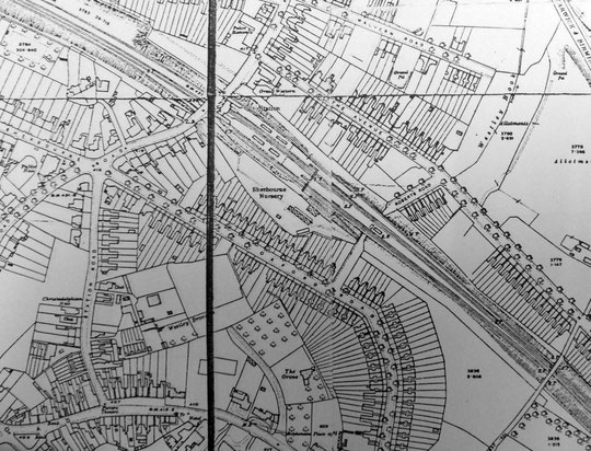
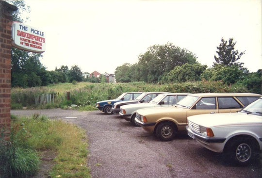
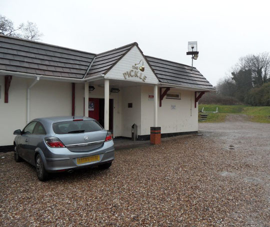
Perhaps the most interesting feature of Roberts Road is the Pickle Club. During the First World War the Sherbourne Nursery, shown on the 1916 map, was taken over by a group of local people anxious to help with the war effort to grow more food. The information shown below is displayed in the club's snooker room.
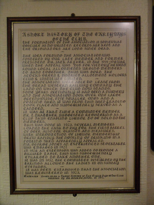
The information below comes courtesy of Jim Jones.
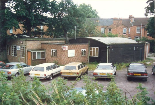
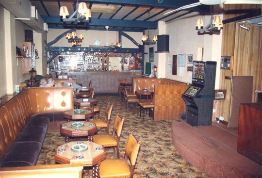
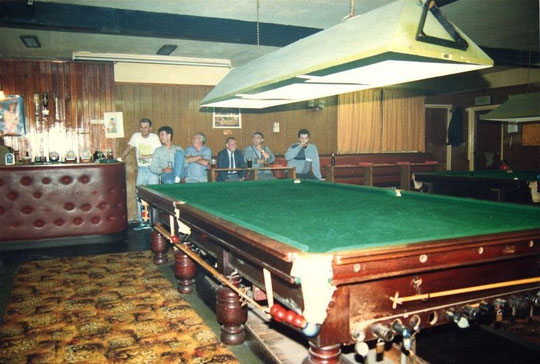
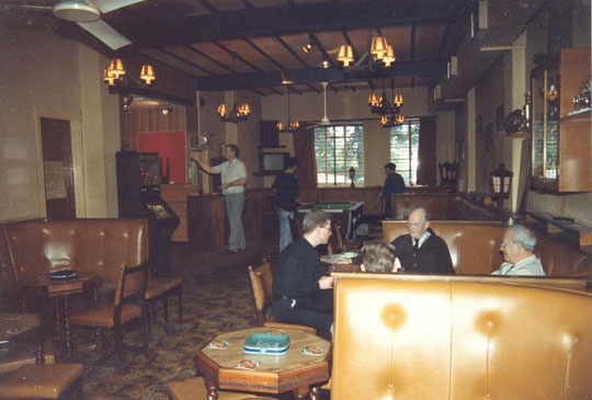
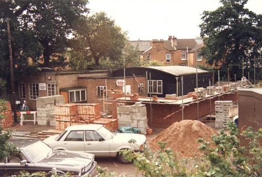
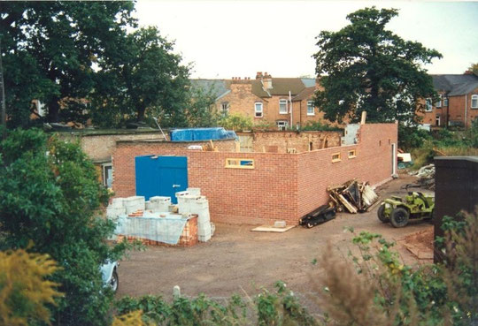
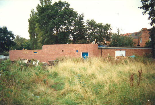
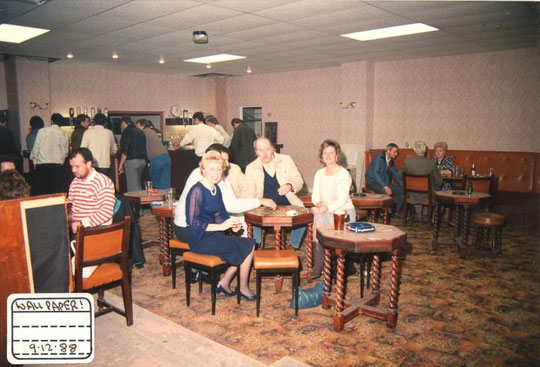
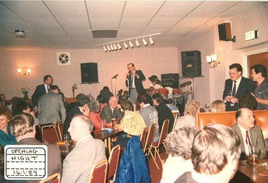
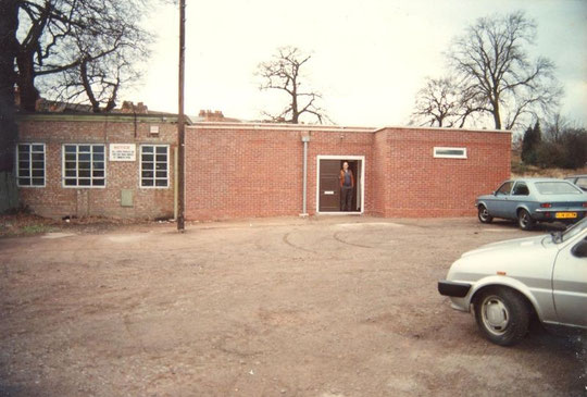
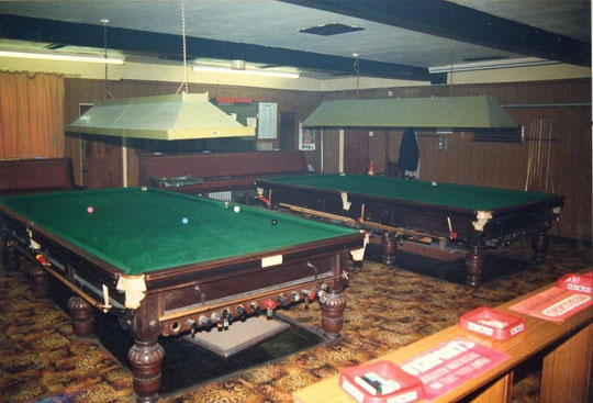
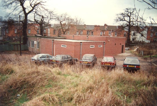
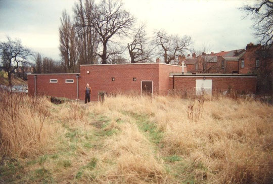
The wooden potting shed eventually became a snooker room when a wooden lounge building was put up in the 1950s. The potting shed/snooker room had a curved Belfast truss roof. The lounge part of the club burnt down in 1971 and was replaced with a brick building constructed by club members. Another brick building was the cellar or drinks store, which was added at the back of the buildings. In 1988-9 the wooden snooker room was taken down and a larger brick building was put up to the right of the lounge and butting up to the existing brick drinks store. The functions of the rooms were reversed: the snooker room took over the left-hand room, and the lounge was put in the new, larger space. Some photos of this transformation can be seen below: thanks to the Pickle Club for permission to present these here.
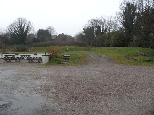
The club has been affectionately called the "Pickled Cabbage", an amusing description which joins the gardening and social origins of the club. While the allotments are overgrown, and indeed part of the land has been sold (in the 1980s) to the Bridge House Hotel (Quality Hotel), surprisingly the remains of a petanque or boules playing area can be found adjacent to the car park. Several games at a time took place here, and the slope above was ideal for spectators to observe the action from. This sport flourished here for a number of years from the late 1990s, and the club was even on the national championships circuit. The Pickle Club had angling, snooker, and darts teams, and a golfing society. Their snooker tables, which date from the 1920s, were hired by the producers of Brideshead Revisited for a twenty-second shot. The club benefited to the tune of several hundred pounds!
The allotments and club land were leased from the railway for many years, and the trouble and expense of maintaining and constructing buildings was a concern given the lack of certainty over the long-term future of the site. Eventually the railway sold the land to the club in the 1970s: they began to regret it when more parking was needed for rail commuters.
Club minutes from the end of the war onwards show the club wrestling with the thorny question of whether ladies could be admitted. At each Bank Holiday or Christmas or Easter period the minutes show that the General Committee made arrangements for ladies, each time to be voted on. There were problems. In 1948 one male member was to receive a letter "instructing him to tell his wife to refrain from visiting Club premises except during permitted times for lady visitors". As time went on, things became more relaxed. Successful flower shows and concerts were other features of the club's activities.
What about the Pickle today? The club frontage has been rendered and provided with a new overhanging roof. Music events and parties are hosted, and the club is still flourishing while so many of the local pubs have gone.


The National Library of Scotland website has 25-inch maps up to the 1930s, and 1:1250 and 1:2500 maps up until 1973. There is also an option to compare Edwardian and current maps of various kinds using a slider. For this use the geo-referenced maps option. This is useful for plotting the exact location of changes.