 Acocks Green History Society
Warwick Road, south side from opposite Stockfield Road to Westley Road
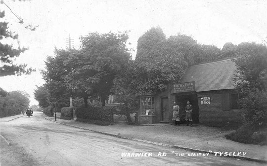
At the time of the 1843 Tithe map, there were very few buildings along here. An 1845 directory mentions a smithy, but that cannot be clearly identified on the map in the location it was known at, opposite Stockfield Road. Then there was a farm owned and farmed by the Parkes family at the corner of Fox Hollies Road. The next building was on the Broad Road corner. This was the Firs, owned by Daniel Palmer Grant and let to the Rabone family as a farm. By 1855 the King family were at the farm. Later the Firs was called Merstowe, and was home to Dr. Cordley Bradford. The 1858 directory mentions a sergeant of police, who may have lived near the Green.
The 1860 directory reveals that a wine and spirit merchant is now in business between the smithy and the Kings' farm, probably at the Fox Hollies Road corner. Some residential development has also taken place. Between the farm, which was at the north corner of the Broad Road corner and the Green, ten dwellings are listed in the 1861 census, of which six or seven can be matched to the directory. The first one, on the south corner of the Broad Road corner, is Flint Green Lodge (later 1063), occupied by Dr. Robert Newhouse. This house was known as Westley Brook by 1901. The next one is Melbourne Villa/House (1065), occupied by Robert Harcourt, retired brassfounder, in 1871. Collingwood (1067) has Henry Ward, gunmaker, and Cranbrook (House) (1069) has Henry Powell, brassfounder in 1871. Enfield Villa (1071) has James McLachlan, a metal and insurance broker. Next there are two houses called Corinthian Villa. The first one going east (1075) has Joseph Taylor, an inventor who made the bomb casings for the failed Orsini plot to assassinate Emperor Napoleon III. The other (1077) has Benjamin McKay, manager of the B.S.A.. Next are two houses called Gothics. These were in a different style and were probably later then the main group west of here. These were probably 1858-9, and the pair called Gothics may be ten years younger. In 1871 the western one (1079) was a girls' school run by Martha Bywater, and the other (1081) had one of the Perceval family in residence. Stone Hall, number 1083, dating from 1858, had William Bourne, gunmaker, in residence in 1871. In 1860 Samuel Robotham, in the wire drawing business, had lived there. The last house in this sequence present in 1861 was a house later called Camden Lodge (1085), occupied by the Johnson family. In the 1861 census Henry Johns(t)on was an accountancy clerk. By 1871 he was a cashier and a copper and metal merchant. The New Inn was probably there by 1859, as it was in the 1860 directory.
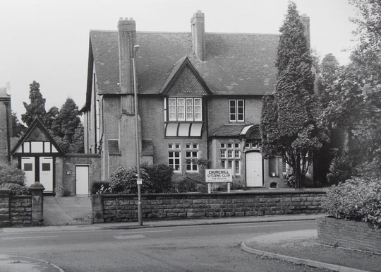
Number 1073, the Knoll, designed for Edwin Cottrell Newey, was later. It was built in 1887. It is remembered for its time as the Churchill Citizens' Club, but it was Warwick Modern School in 1940 and a St. John's Ambulance branch for around twenty years from the 1950s.
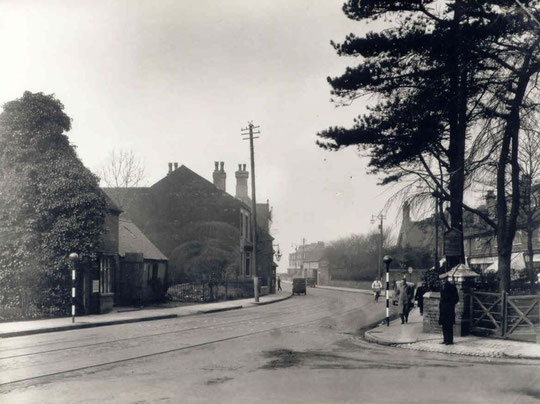
After Camden Lodge came a narrow pair of semis, later called St Mary's Cottage (1087) and Park View (1089). It stood opposite Dudley Park Road, the bottom of which remained free of houses until 1923. This pair is certainly there in 1881. One house followed (1091), which was the police station until 1910. From 1919 until 1925, the Birmingham Municipal Bank was in the left half of this building. A set of ten cottages, set at right-angles to the road, separated the police station from the New Inn, listed in the 1861 census.
Going back to opposite Stockfield Road, municipal housing appeared here in the 1960s (921-981). The house called Highfield (old 937) was demolished, as were prefabs 959-61, part of a small group which extended along Fox Hollies Road. The Prefab Museum entry says these were of the Uni-Seco type. The building line was made curved at the corner as part of the new development, as if in preparation for a new layout at the junction, but this has not been done even now, and a patch of grass announces the half-century-old intention. On the east side of Fox Hollies Road a new doctor's surgery building (999) appeared after the war. The doctor had been at 1001 from 1930. 1001-35 are from the mid-1920s. Merstowe Close is inter-war, and a new house on the west corner at the main road was added in 2016. The house once called Merstowe, a rebuilt house on the site of the Firs (1061), was replaced c. 1980 by a group of smaller houses on the Warwick Road, Merstowe Close and Broad Road.
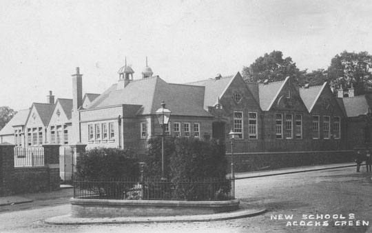
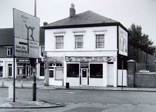
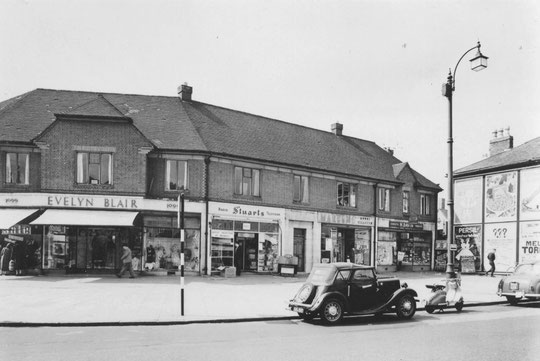
In 1984, three houses going east from Broad Road (1063-7) were replaced by many more smaller modern Housing Association-built dwellings (1047-63), with others added on Broad Road (1A-1H). The Gothics were demolished in 1989 and replaced by a care home a few years later. This closed in 2016. Between them and Stone Hall, an inter-war house was built (1081A, Chads hunt), and an annexe to the west side of Stone Hall also appeared (1081B Bardfield). These appeared in the early 1920s. Stone Hall now has a long history as an adult education centre. Acocks Green school opened in 1909 east of Stone Hall. Camden Lodge became a garage, and later a fish and chip shop. Next to the New Inn, a single-storey facade at one end of the old cottages became Ellard's sweet shop, demolished c. 1935. At that time, everything from Camden Lodge, including the New Inn, was swept away to enable the Green to be enlarged. Westley Road was shortened, and new shops were built around the corner. Camden Lodge survived until c. 1988, when a new building replaced it. From then the barber's shop was on the right and the takeway on the left (see below).
1021 was a dentist's practice from the 1930s until the 1950s. 1061 remained a surgery until c. 1940, when it became flats. 1063 became a surgery in the mid-1920s. 1069 was converted into a boarding house c. 1991, later the Coach House Hotel, then a restaurant/hotel. 1071, or Sanderling House, converted to offices c. 2002, but may have a residential future again (an application to return it to residential was made in 2015). 1075 was an accountancy practice in 1945. It is known as Bartlett House now. 1077, or Rachael Court, hosts businesses.


The history of the Warwick Road in Acocks Green
North side of the Warwick Road, Stockfield Road to Station Road
North side of the Warwick Road, Station Road to Lincoln Road
South side of the Warwick Road, opposite Stockfield Road to Westley Road
South side of the Warwick Road, Shirley Road to Olton Boulevard East
It is now possible to see the sequence of large-scale O.S. maps online at www.old-maps.co.uk. For this road enter the postcode B27 6QG, and choose the 1:2,500 maps up until 1952-4 (there is no 1937 map at this scale). Use the plus and minus buttons to change how close up you wish to see the houses. The map can be dragged by using click and hold as normal.