 Acocks Green History Society
Ada Road to Forest Road
Beyond the cinema and Ada Road stood a row of houses, initially with names, that were demolished by 1975, therefore could not be photographed by the Hay Mills Project. They were on the 1905 O.S. map, so were there up to a couple of years earlier.
In 1920 the sequence of names was:
1213 Parsonage House (in 1911 for St. Cyprian's), 1215 Tiverton, 1217 Hazelmere, 1219 Hillcrest, 1221 the Hollies, and 1223 Hildathorpe.
Then there was a long gap until opposite Flora Road. Here was an old group of buildings, including a long-lasting grocery shop, numbers 1-4 Redhill Cottages, later numbers 1255-1261. They certainly go back as far as the 1840s, with Joseph Harris and Joseph Farmer as tenants of the Road Commissioners. In 1871 Joseph Farmer is a labourer there and Joseph Harris is a grocer. In 1881 his daughter Esther Hiley was running the shop. There was still a grocers there in the 1920s and a shop until World War Two. Further east was a row of Charity Cottages belonging to Yardley Great Trust. They had gone by 1905. These may have been outbuildings for the workhouse. Numbers 1255-61 last appeared in 1959 Voters Lists. Hoardings there were applied for in the same year. An application for hoardings covering the stretch from numbers 1223-61 was made in 1981. A similar application had been made for numbers 1213-23 in 1975 and was permitted for two years. A car sales company applied to use the stretch from numbers 1223-61 for their business in 1977. They appear to have been there since c. 1955. Another application to store damaged cars off Ada Road was made in 1983.
Just east of there, by Waterloo Road, was a gentleman's residence in its own grounds. This was probably where John Holloway lived. He was a businessman in Birmingham, and an inventor, with an 1846 Patent for a buckle-chape. He was certainly at Red Hill by 1860, and was listed in a Yardley directory for 1855. He was still alive in 1889, but the effects of the late John Holloway were being offered for sale in May 1890. Number 1273, also known as The Mount, was residential until the early 1920s. It was occupied by William Arthur Marrian in 1900. He was described in the 1901 census as a managing director of a public company. A business making pipe fittings and valves appeared shortly after the end of residential occupation, at number 1277, possibly on the same site, which was full of warehouses by 1950. 1277 also referred to Kwikform's business, which also included a house on waterloo Road with a portico once lived in by the Yardley Tannery's Homer Muscott.
Land nearby belonged to the Robins family in the 1840s, several fields between Speedwell Road and the Coventry Road. They gifted allotment land with covenants for leisure use to Birmingham Corporation in 1951, but the City decided to do just what it wanted with the land, much to the family's annoyance and that of the Redhill Residents Association. It eventually went to Economic Development.
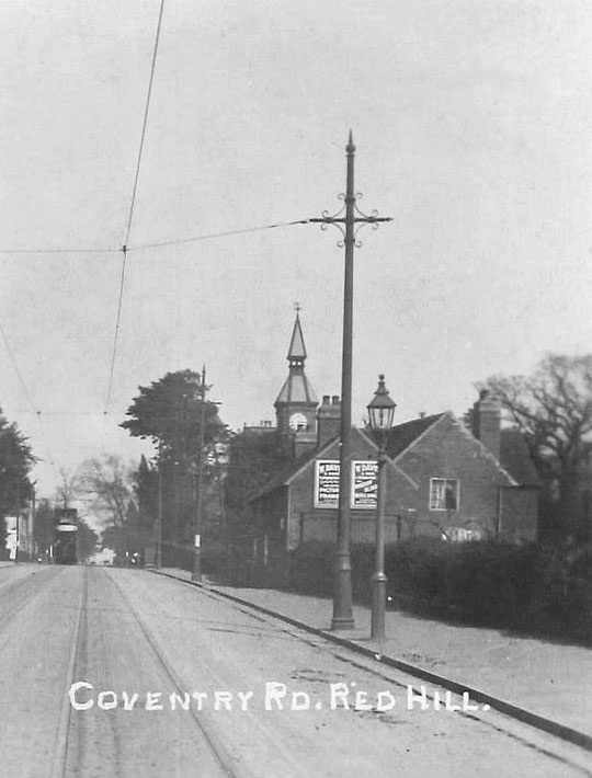
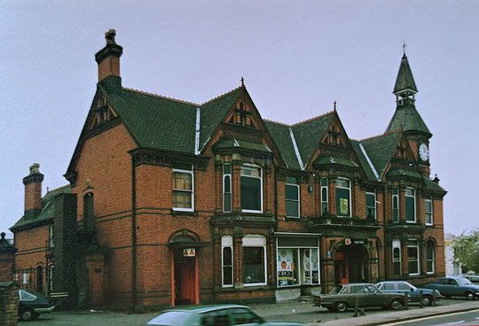
The licence went to the converted former Worcestershire police station at the corner of Holder Road. Police and the name of the demolished pub were combined as the Old Bill and Bull. Extra compensation had to be paid to the owners of the Bulls Head, as it turned out to be busier than expected before demolition.
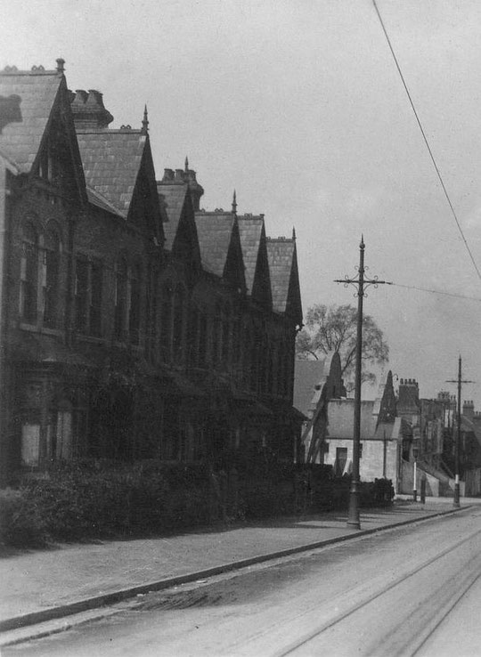
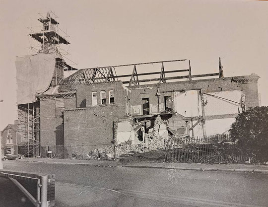
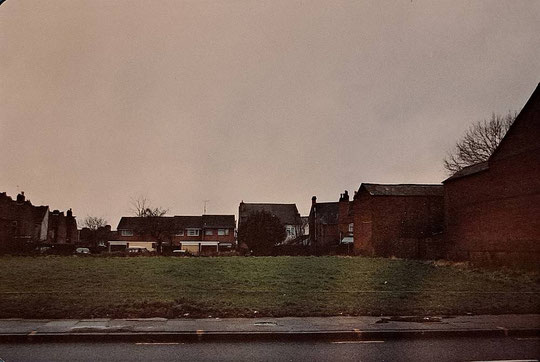
Houses were built east of the Bulls Head around 1905. Numbers 1303-13 were demolished first, and the gap is shown in the image below.
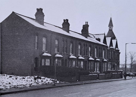
The first seven houses east of the Bulls Head were known as 1-7 Leam Villas until the early 1920s. They were built c. 1898.
Numbers 1303-13 were there by 1888. Originally they were named. These changed with the occupants at times, but the sequence appears to be:
1303 Victoria Villa/Hazeldene, 1305 Bleak House, 1307 Red Hill House/Charnwood, 1309 Glen-Ellen/Whitcliffe, 1311 May Villa/Glen Maye, 1313 Ivy House. A Bleak House is mentioned in 1872, but it may not be this one.
All were listed in the 1968 Voters' Lists. By 1970 only 1303-7 were listed, and all had gone by 1971.
There are no images of these houses in the Hay Mills Project archive.

Frederick John Briley, a builder, came to this house in 1883. Before then he was at Green Lane, Small Heath. Another builder was listed in this area in the 1881 census, a Mr. John Vernon. He may have built the house, which went back a long way in the plot and probably had part business usage from the start. In 1906 there was a brewer at Belmont with a malthouse, a Richard Matthews. Frederick Jones, bricklayer, was in the house in 1911, but Mr. Matthews was still listed at the malthouse in 1912.
Frederick John Briley had to deal with bankruptcy and fraud against him in the 1880s, but he gained contracts locally and in the City:
He was involved in the building of Redhill School in the 1890s.
He built a house in Woodbourne Road, Edgbaston, for the architect Yeoville Thomason, of Council House and Fox Hollies Hall fame.
He was the builder of the Victorian Smithfield Market Buildings in the City centre.
He was the builder of Moor Hall, Sutton Coldfield in 1907
He altered a double-fronted house on the Warwick Road, Acocks Green, so that it could house the second location of the Birmingham Municipal Bank in that suburb.
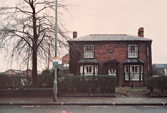
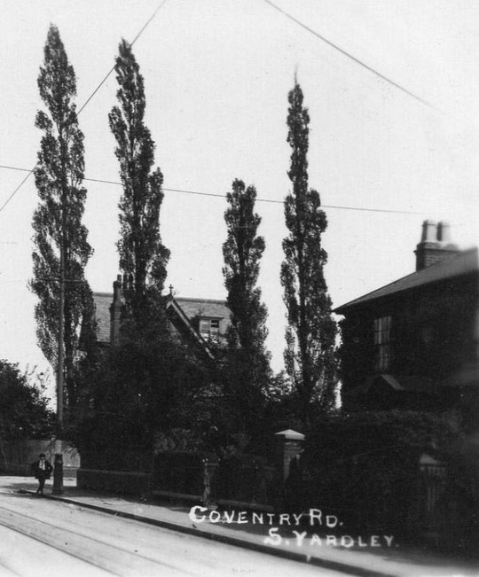
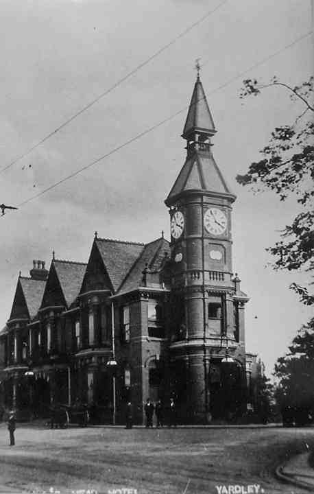
In the 1890s Frederick John Briley moved to another house on Forest Road just opposite Belmont, which he probably did build: Hillcrest. It is the one behind the trees in the postcard above. It had substantial outbuildings for his business. He was still there in 1939. He died in Solihull in 1941.