Acocks Green History Society
The Coventry Road from the river to Kings Road
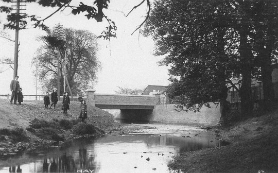
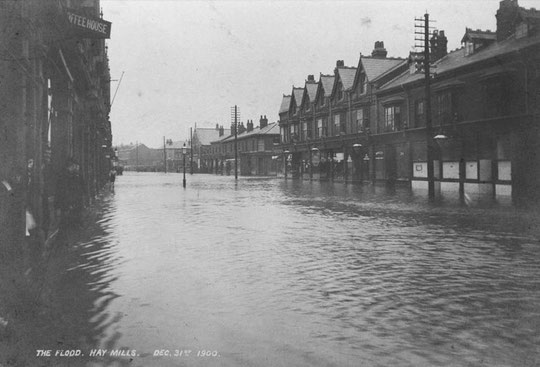
The River Cole is the former Parish, Ward and County Boundary. When the road was turnpiked, a tollhouse was built just west of the river. By the time the river bridge was widened in 1903 to enable electric trams to go up to the Swan, the tollhouse had become a provisions shop. The works resulted in the demolition of the building.
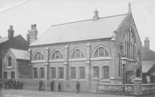
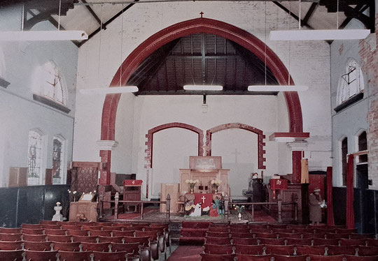
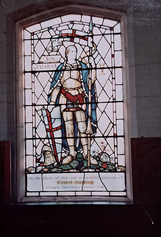
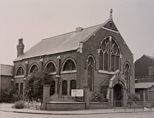
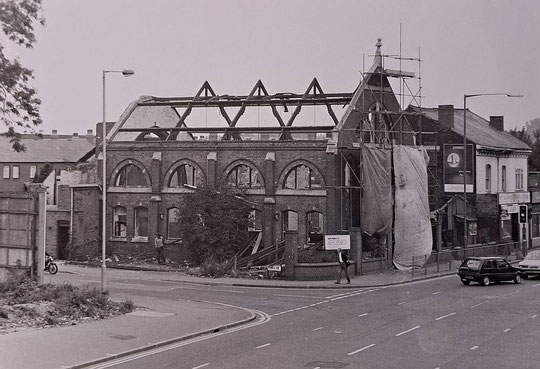
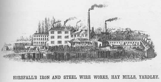
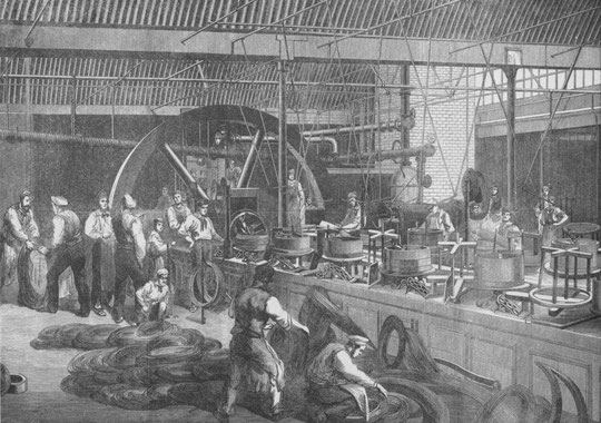
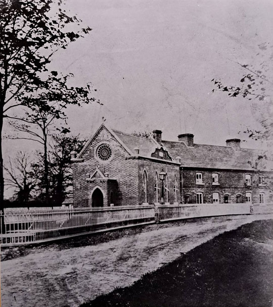
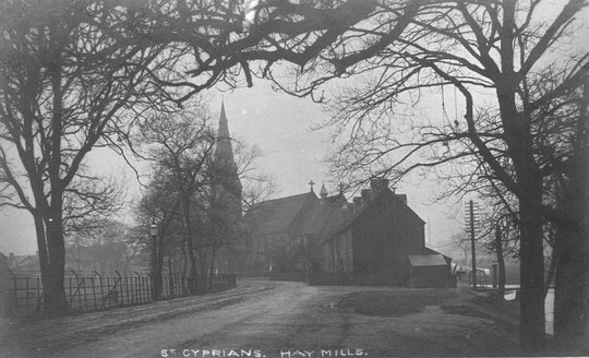
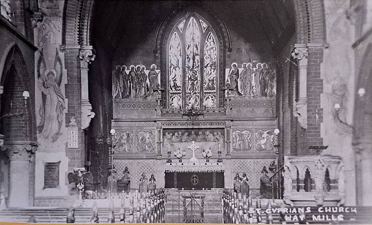
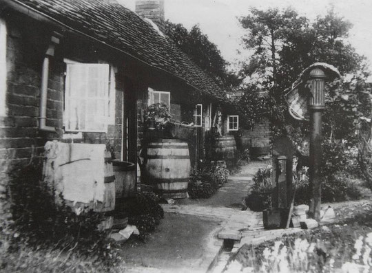
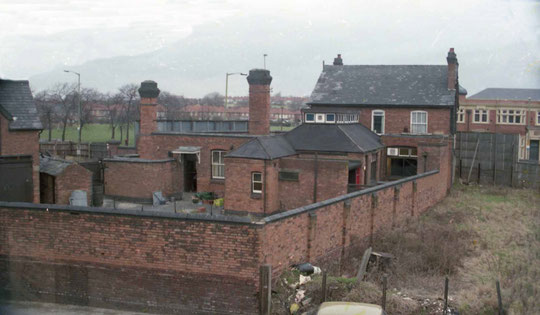
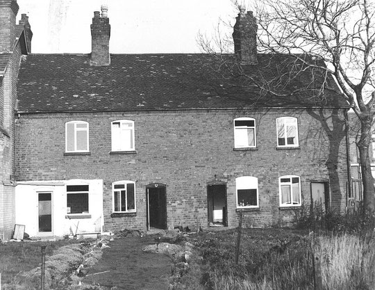
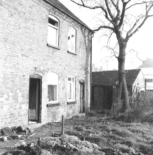
The reason why Hay Mills developed as it did is because of the arrival of the wire works, which took over the old Hay Mill site. James Horsfall leased the site in 1841 and later bought it. After entering into a partnership arrangement with the Websters of Sutton Coldfield, 1859 saw the Websters' business transferred wholesale to Hay Mill, including the workers. Cottages were built along the Cole, then a schoolroom in 1861. This became a chapel, and a new school was built nearer the factory in 1863. This still stands. The older building was incorporated into part of the nave of a new church of 1872-4, designed by Frank Barlow Osborn. This is a very attractive small church. Curiously, water from the old tail race flows under the church into the Cole. The weir there originally prevented excess water flowing past the workers' cottages but after the tailrace was filled in it would have carried whatever water was still passing under the factory. Wartime damage led to the loss of some cottages and the original reredos in the church.
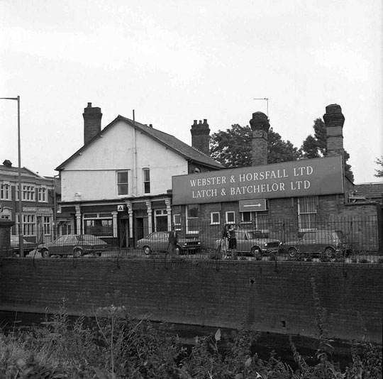
Webster and Horsfall became famous for the part they played in the Atlantic telegraph cables. Some accounts say they made the wire, but in fact they made only the helical sheathing layer. Nevertheless, they were very important players in this venture, and their cables were used to retrieve the first broken telegraph cable from the seabed as well. At the end of the nineteenth century Latch and Batchelor joined the enterprise. Volunteers are building up, cataloguing and promoting an archive of Webster and Horsfall.
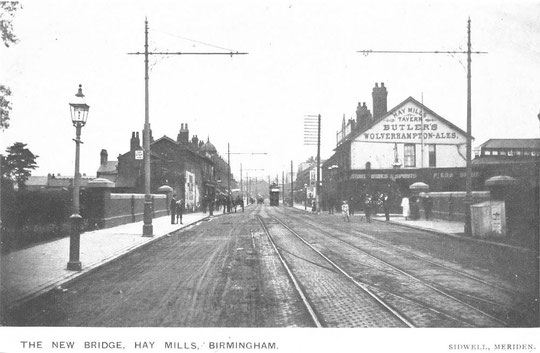

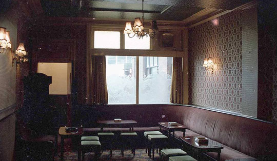
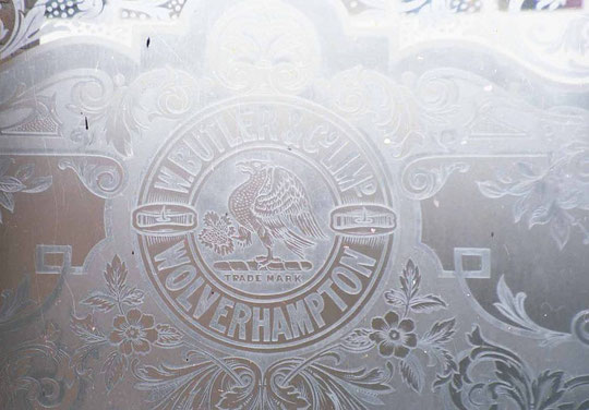
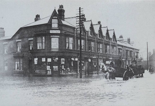
The tavern was built where there were gardens in the 1840s. Joseph Holmes was listed there as a victualler in 1855, and was still listed there in 1868. In the 1872 directory Mary Ann Holmes was licensee, but Charles Evans was there in 1876 and 1884, with a reversion to Mary Ann Holmes in 1880, who became Mary Ann Evans by 1886. In 1896 the licensee was Richard Chambers Harrison, however in the 1901 Census it was Thomas Crudge. The Hay Mills Tavern sold Butlers Ales. A newspaper article in February 1983, shortly before demolition, said it had been in existence for 160 years, perhaps a slight exaggeration, for that site anyway.
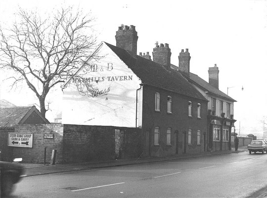
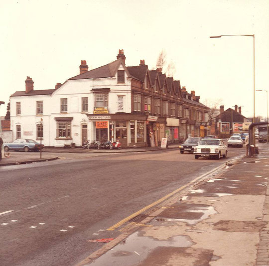
In the 1962 directory a hardware merchant's business was listed at number 1011. This was also the Monaco Consulate, somewhat surprisingly! The Consulate listing had gone by 1973, but the hardware merchant was still listed. In the image above, the site is occupied by a Cash and Carry business.
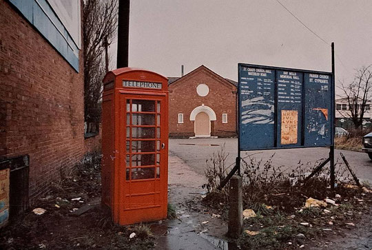
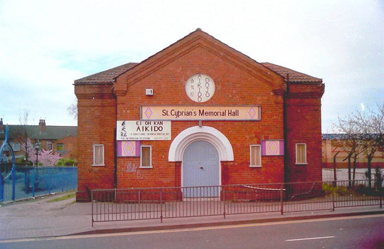
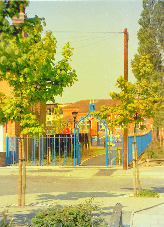
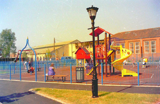
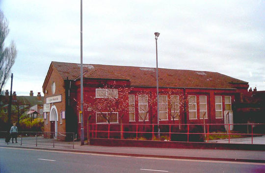
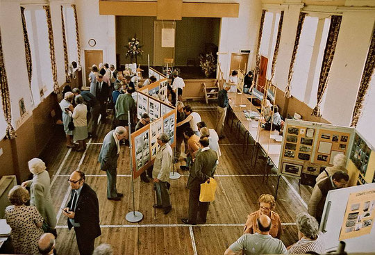
As said before, a gap remained between the Hay Mills Tavern and the shops rows, which was partly filled in by the Hay Mills Memorial Hall, which was built in 1922/3. This was used by St. Cyprian's and also by St. Chad's, who had a Mission Room in Waterloo Road. The Hall survived road widening, but succumbed to the large Sainsbury-owned development of the mid-1990s. They had to build the church a new hall, which dates from 1997, and which was refurbished c. 2020. It is just at the entrance to the Fordrough from Heybarnes Circus. KFC was added to the retail park in 2013.
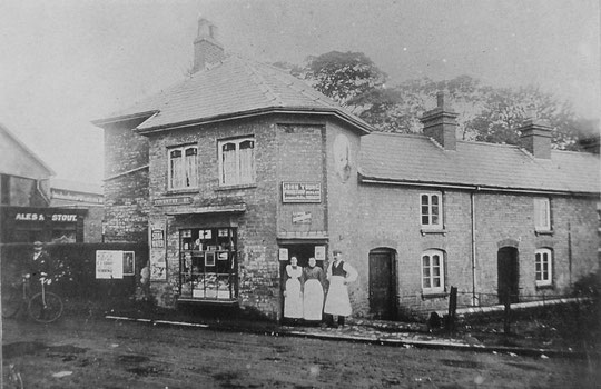
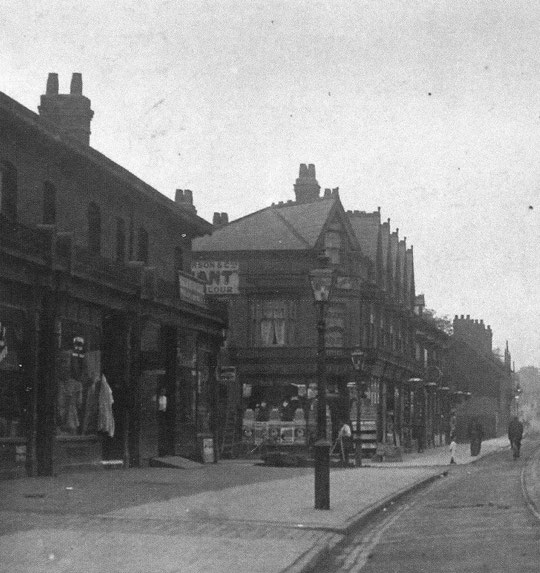
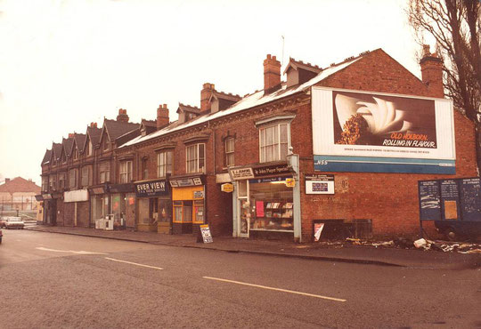
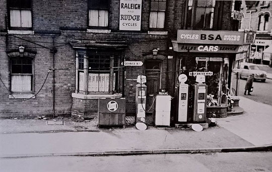
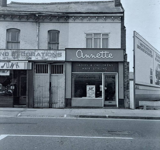
The 1888 O.S. map shows a small group of shops at the field boundary east of the Hay Mills Tavern cottages. Four unoccupied buildings were listed in the 1881 census before these cottages, so this perhaps gives a new build date. There was also a Baptist Chapel shown. Further shops were built to the corner of George Road by 1900. In 1899 Jane Hiley was running a news agency in the first shop (number 10, later 20, then 1027), but there was a cycle maker at the back. Later she was also a coal dealer. This shop was a newsagent right through until the end. By 1908 Mrs Hiley had gone, and George and Agnes Cherrett were in place, together with a coach-building business. By 1921 it was the Swift Electric Company at the back, with William Baker as the newsagent.
In 1913 next door (12/22/1029) was a dairy, then came a china dealer, followed by a furniture dealer (16/26/1033). This was the original part of the row, according to the 1899 directory, added onto which was a series of gabled shops to George Road. As the postcard shows, the new shops were there in 1900.
The 1901 Census Enumerators had fun with the confusing numbers. For them, number 2 was the Hay Mills Tavern, then came the cottages (4-10), and the shops started with number 20. By the time they got to George Road they had counted themselves at number 38. They suddenly found that the baker on the other side of George Road was number 30! 30 to 38 were given the suffix 'a', then they breathed a sigh of relief, because the nearby new Congregational chapel could be given the number 40. The other side of Kings Road started with number 44, and all was well again.
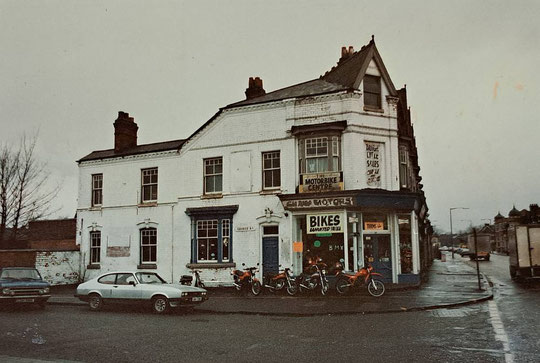
The first business on the other side of George Road was a bakery. The shop itself was Victorian, but the bakery itself, next door on George Road, was very old. James Mansell was listed there, at number 1047, at the Hay Mills Bakery in 1891, and in 1881. A coffee house was adjacent in 1881. It is possible this was the first of the shops to be built going east from George Road, built at the same time as the first shops across George Road. It would appear that James Mansell later took over the coffee shop for his own business. After World War Two number 1047 was occupied by radio and electrical businesses. From there were initially two houses called Primrose Villa/House, Woodland Villa, and two called Prospect Villa on the 1891 census. The Congregational Chapel and its hall followed to fill the frontage to Kings Road after 1899.
Beyond the corner premises, some of numbers 1049-59 are in an 1899 directory (numbers 32-40), but are in the same style as the corner business, so that may have been a rebuild. By then the last two were already Kesseller's General Dealer. By 1908, all were business premises.
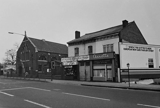
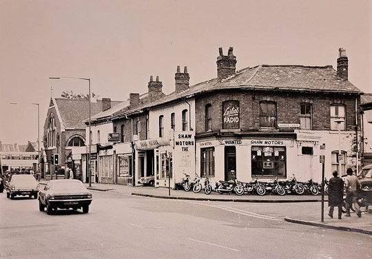
The building on the left in the image above is the Congregational Chapel, built in 1899. It lasted one more year after the photo before demolition. The congregation took over St. Chad's on Waterloo Road.