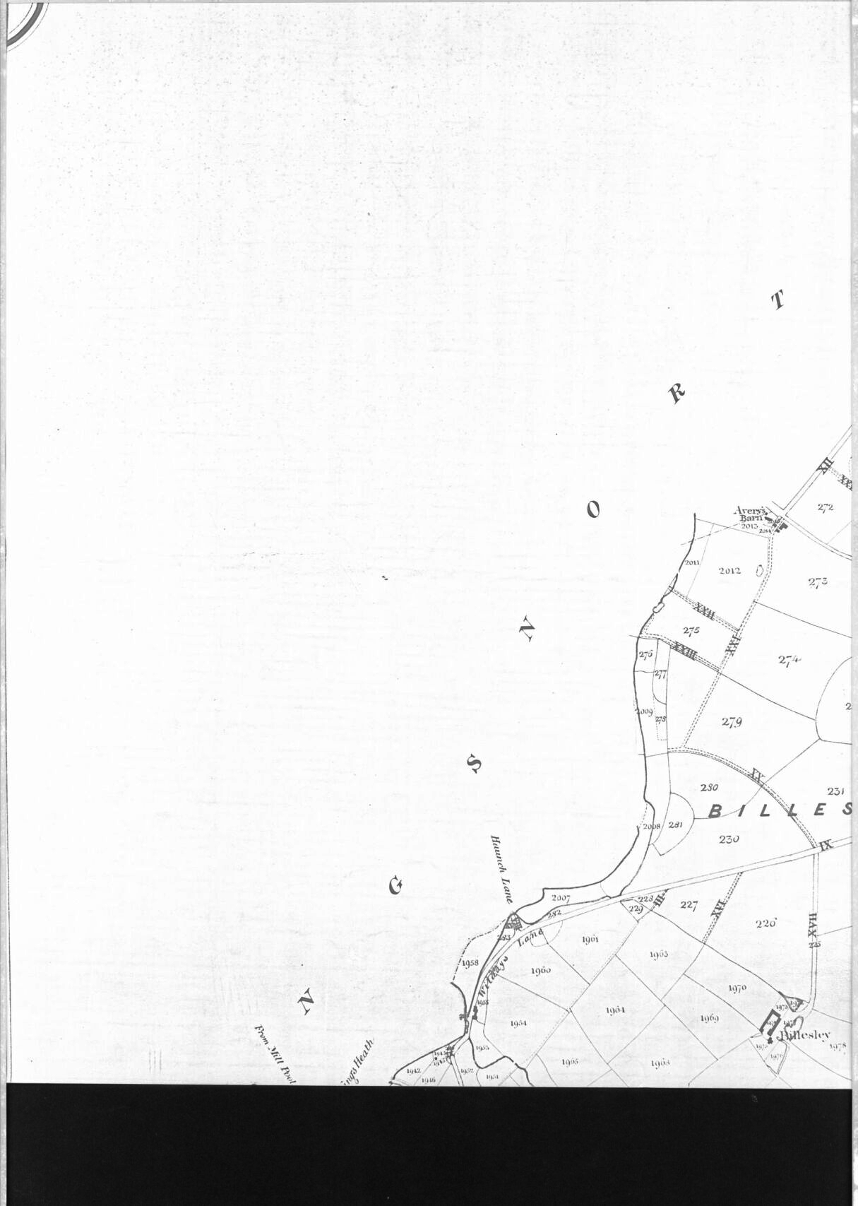
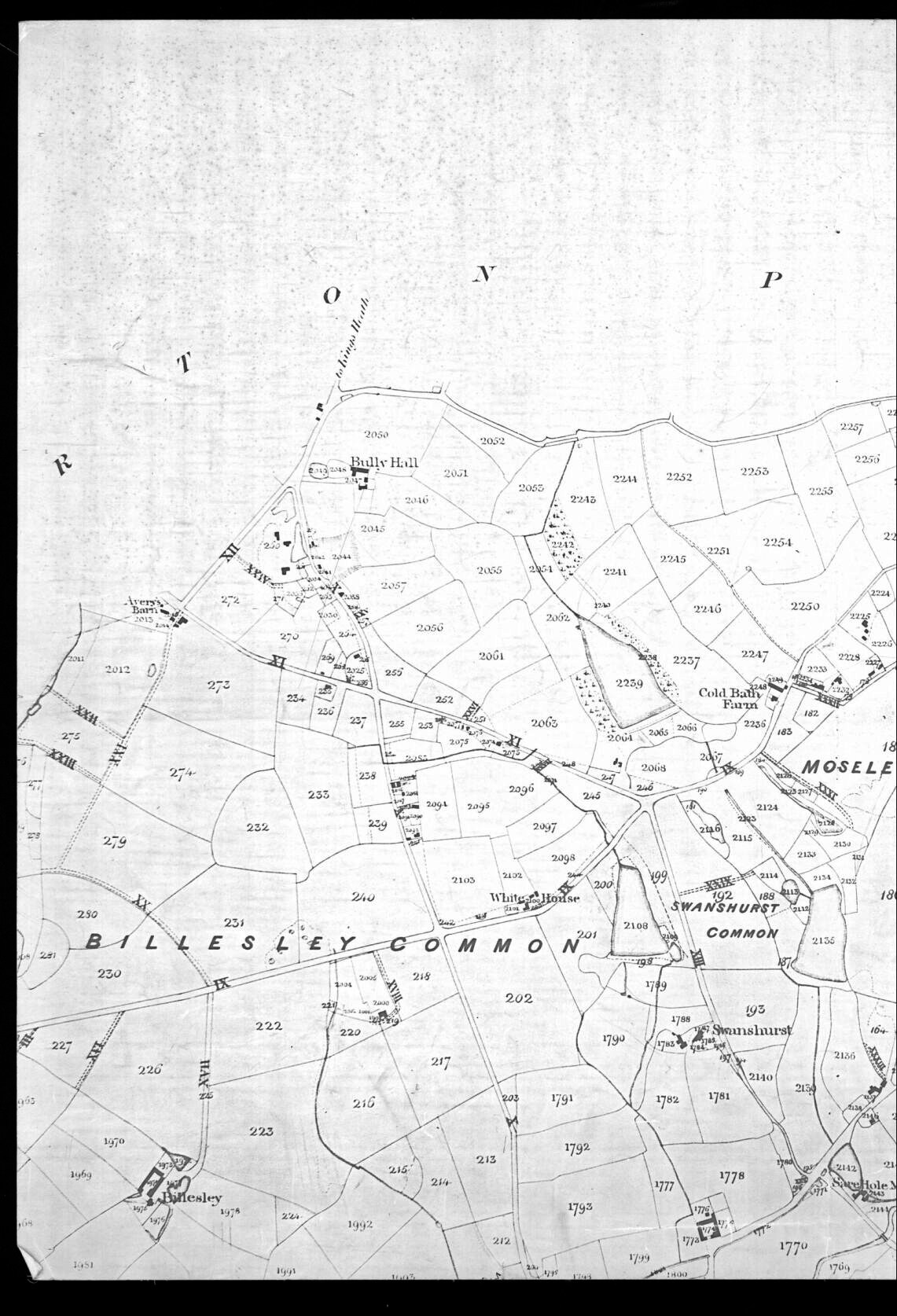
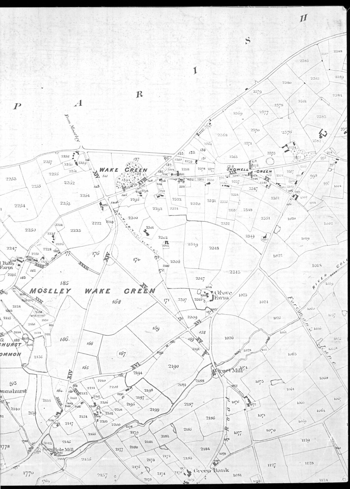
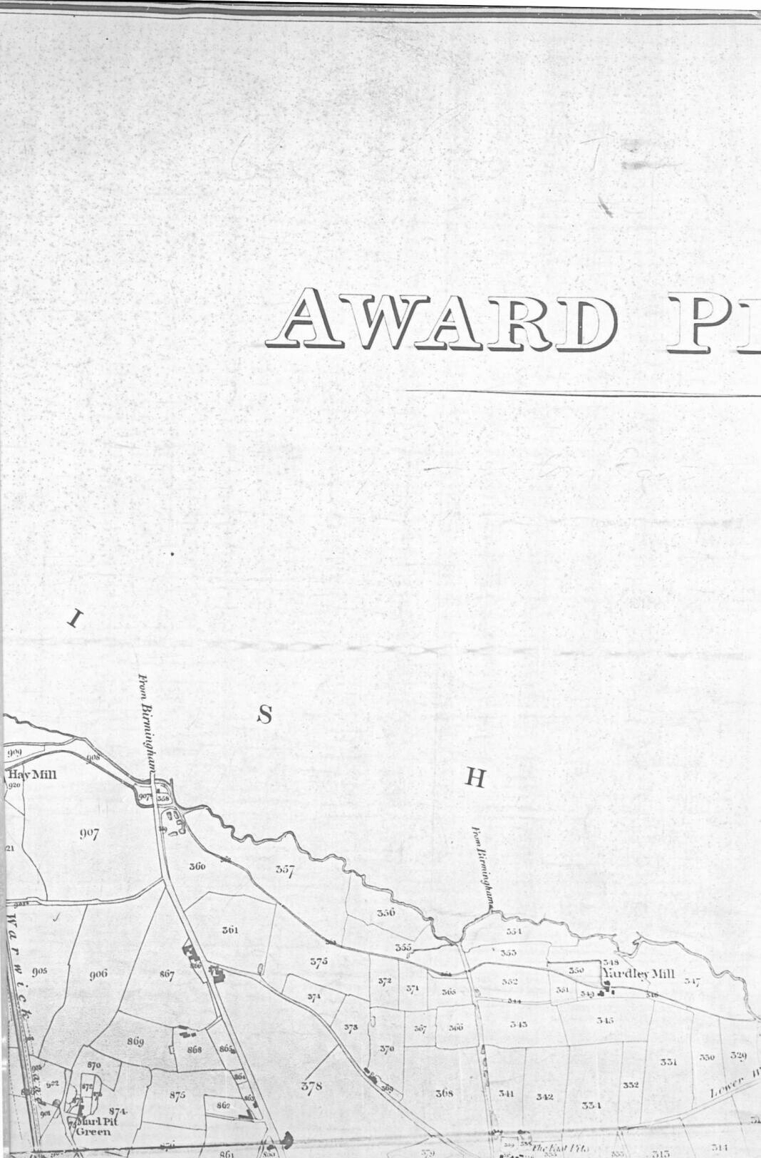
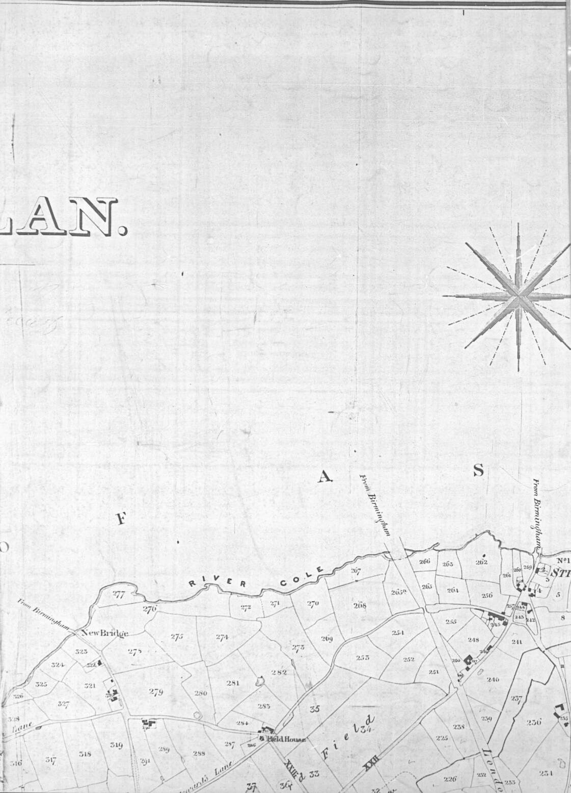
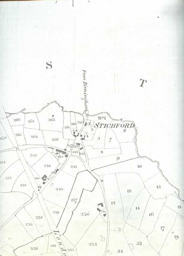
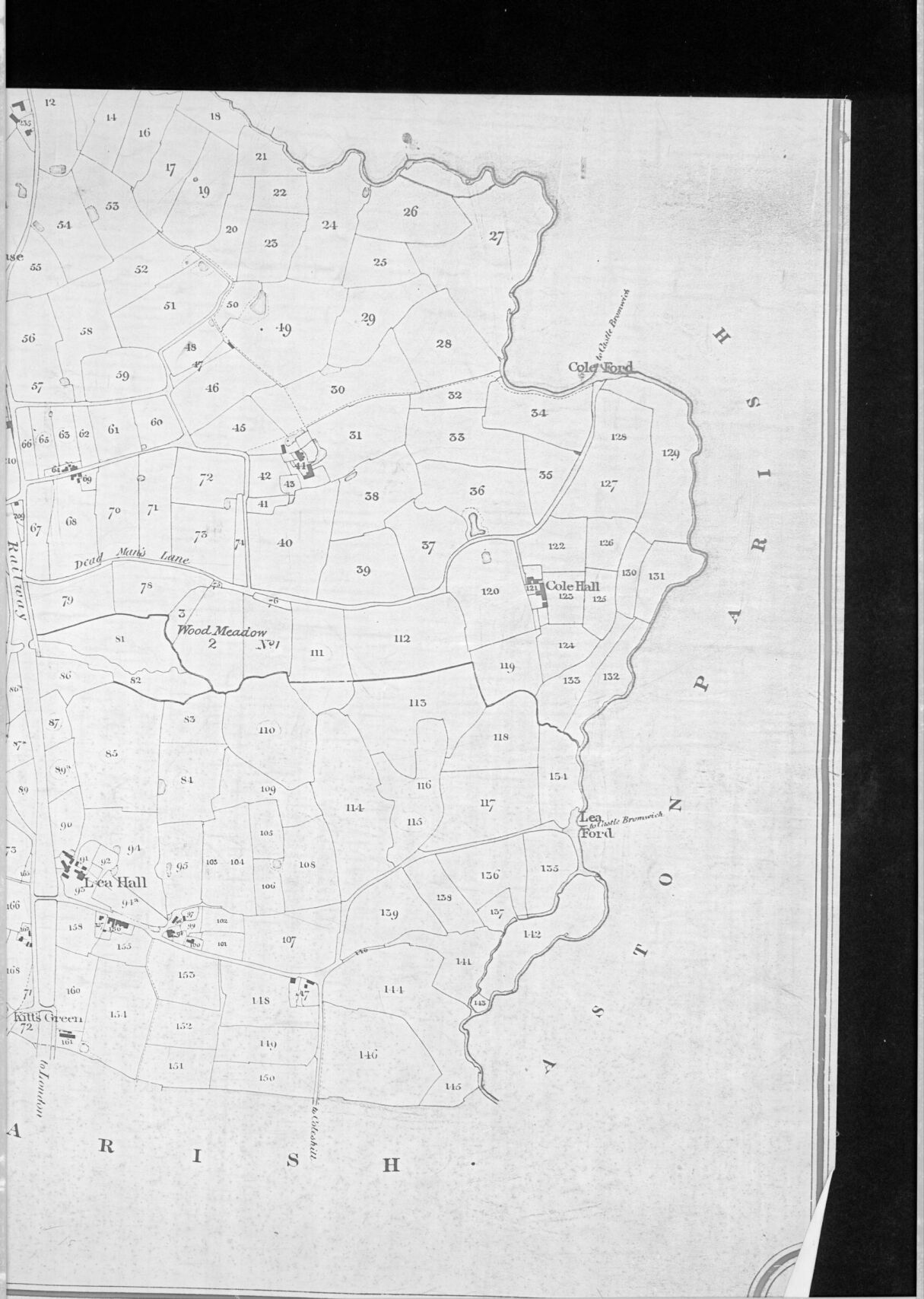
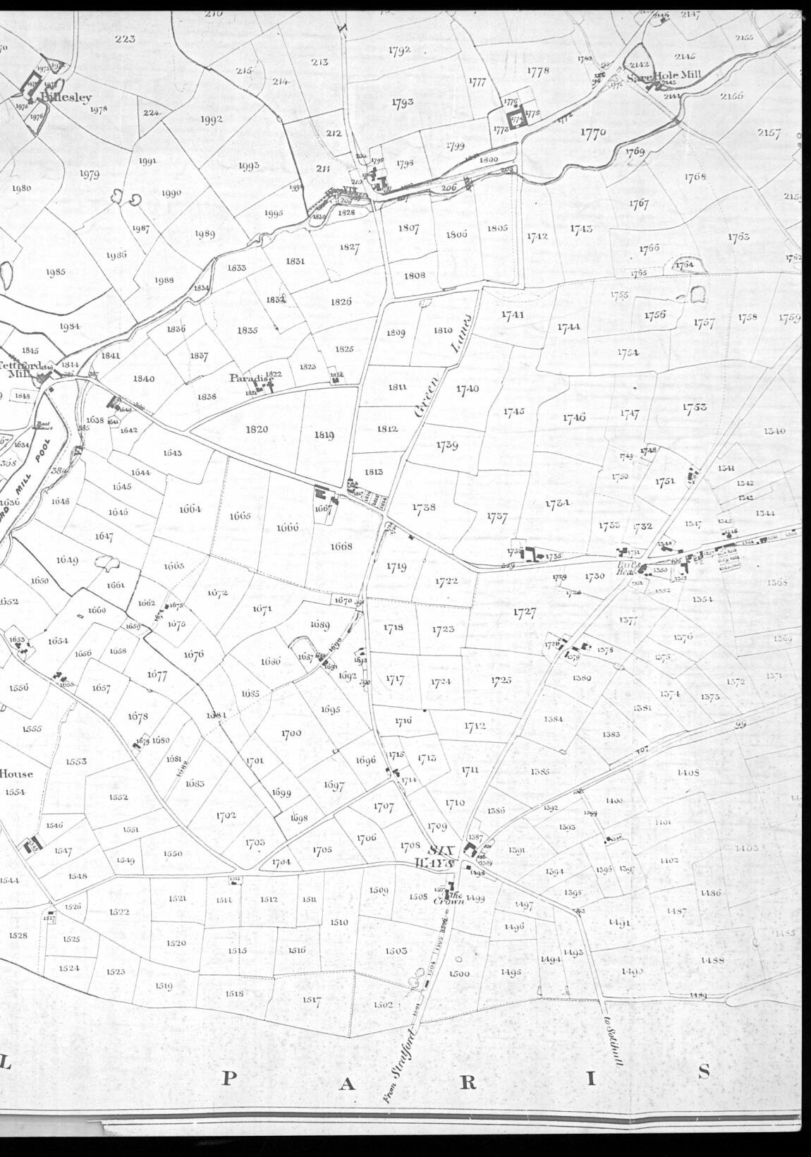
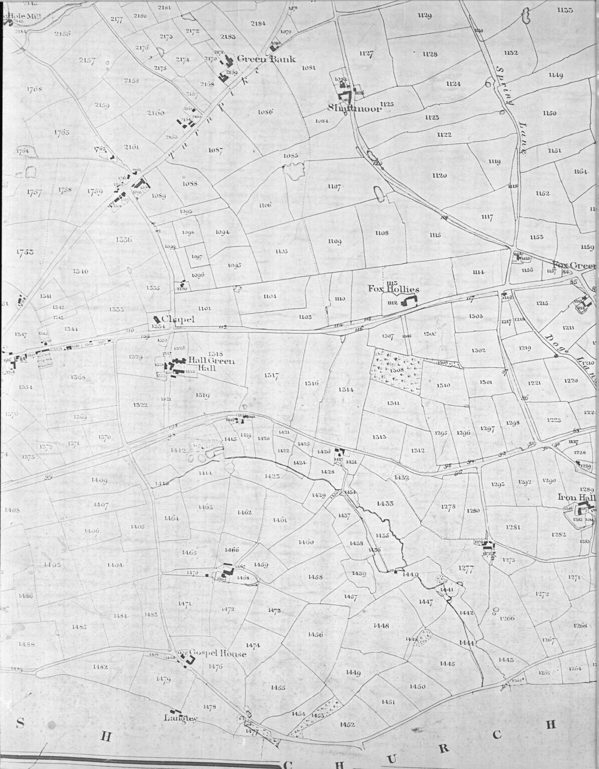
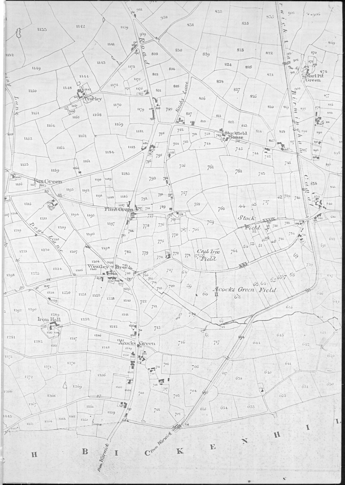
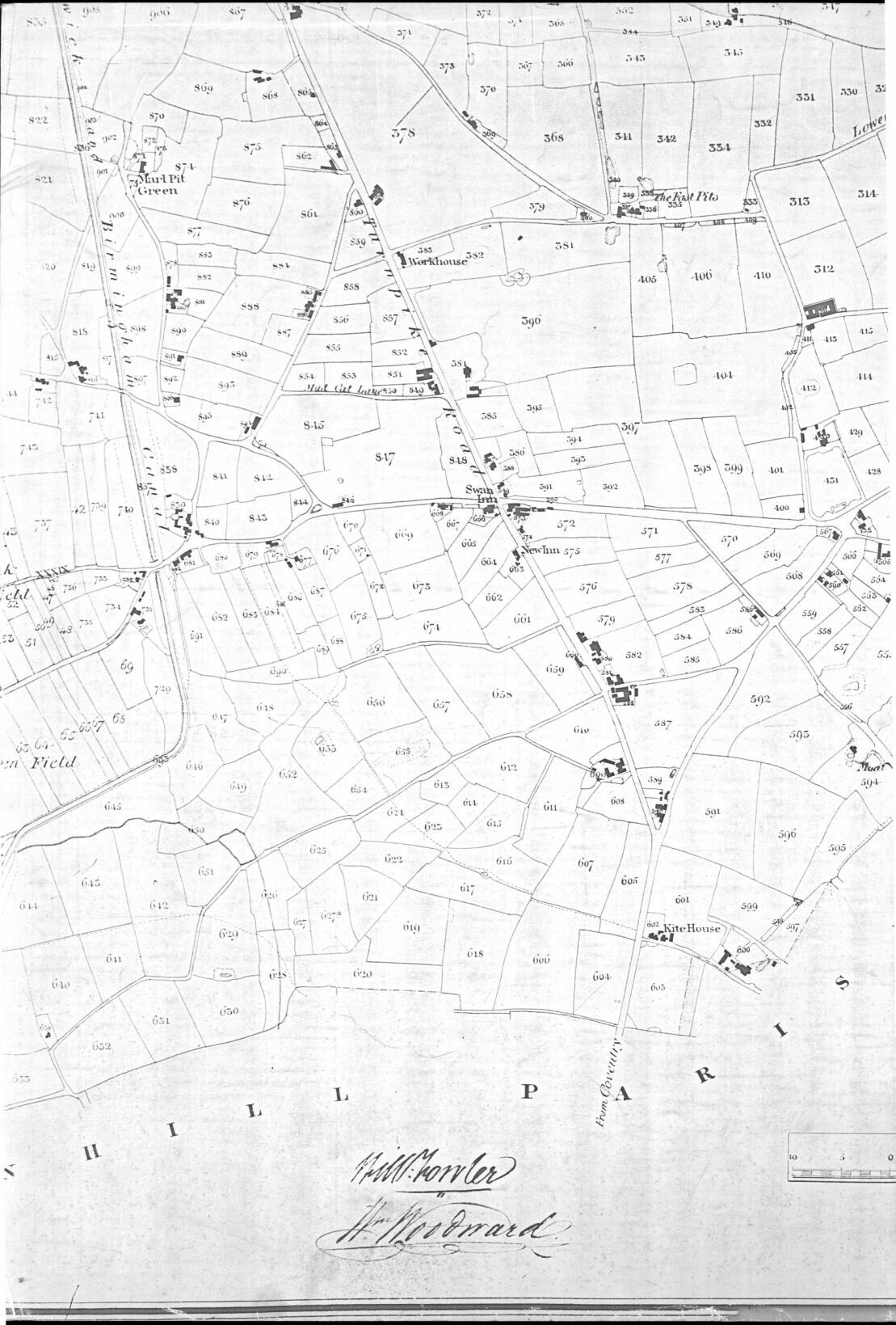
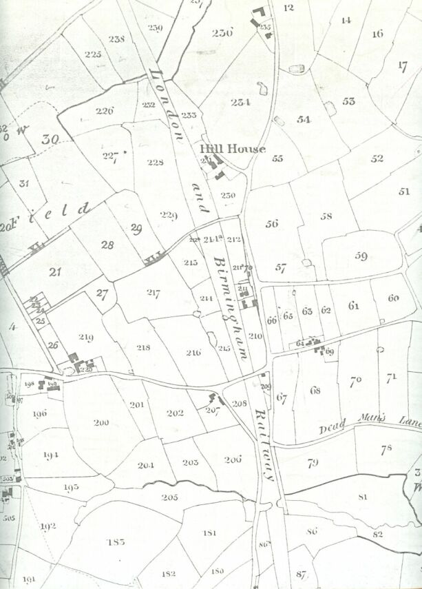
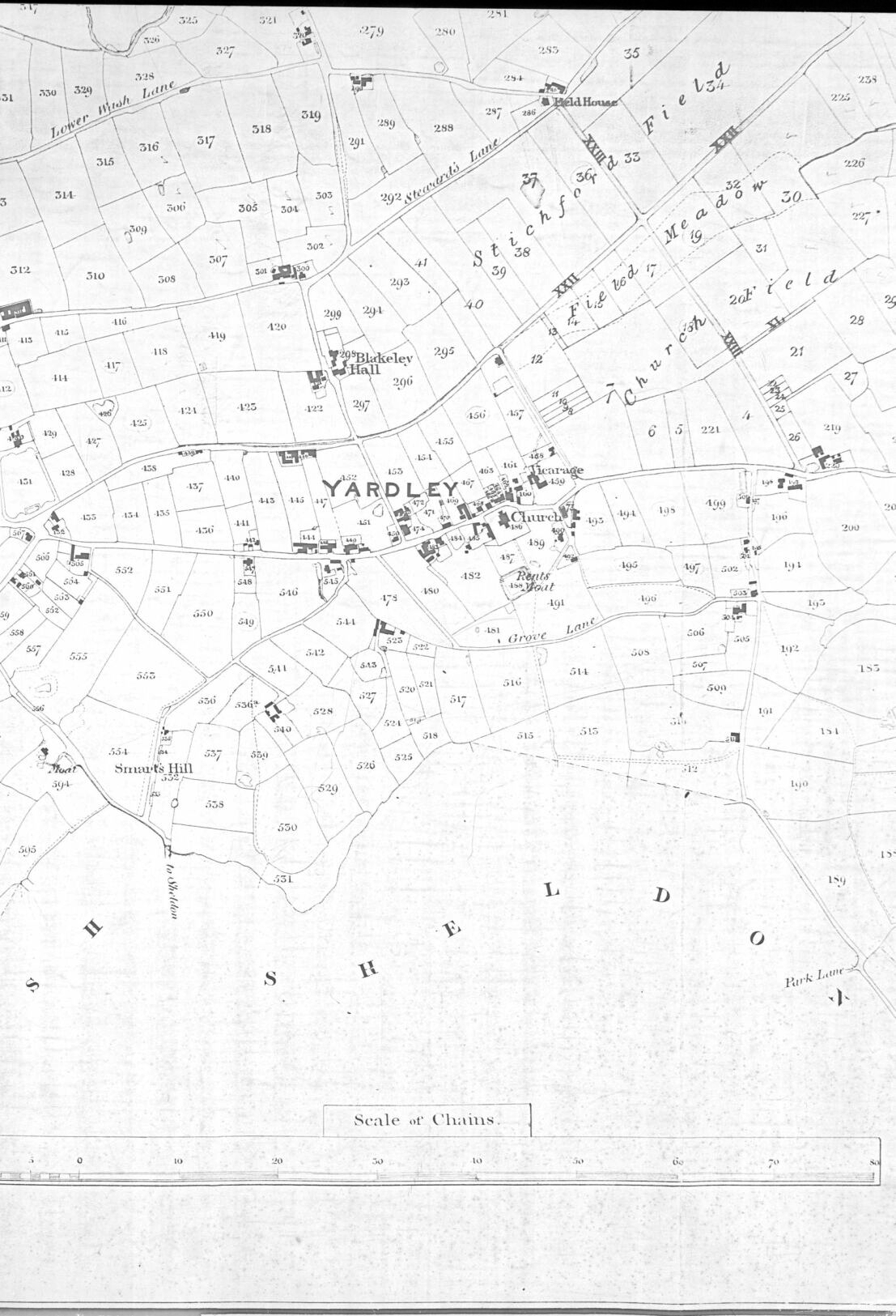
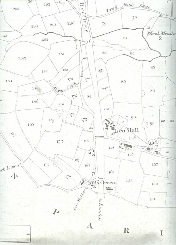
The Tithe Map of Yardley Parish 1843


These maps have been scanned from photographic copies in Birmingham Central Library's Local Studies and History Department, with permission. They may be used for private study, but not distributed, placed on any other website, or used for any commercial gain, without the permission of the owners being provided in writing.

The maps appear in the following order: from left to right along the top of the original, i.e. south to north on the western side of the Parish, then from left to right along the bottom of the map, i.e. the eastern side from south to north. There are a few smaller maps which fill in some gaps in the large ones.


Place names and lane names, but not those of main roads, streams or rivers, have been included to assist with identifying which map may be of interest. The plot numbers can be used to search the Tithe Apportionment, using the Edit/Find function, and the landowner, tenant, field name and field size can be discovered. If a cell is blank, scroll up the page to find the name which applies. Please go to the Field numbers in order page from here, and follow the instructions there.

Please click on the thumbnails to see the maps at full size. The images are very large files, and may take some time to display. If they appear initially at a small size, place the mouse over the image until a button appears at the bottom right-hand corner of the image, and click that.

Avery's Barn, Billesley Common, Billeseley Farm, Haunch Lane, Wildays Lane
billsleya.jpg
JPG Image 451.9 KB
Avery's Barn, Billesley Common, Billesley (Farm), Bully Hall, Cold Bath Farm, Moseley, Sarehole Mill, Swanshurst, Swanshurst Common, White House
billsley.jpg
JPG Image 811.0 KB
Cold Bath Farm, Green Bank, Greet Mill, Grove Farm, Sarehole Mill, Showell Green, Swanshurst, Swanshurst Common, Wake Green
mosely.jpg
JPG Image 796.9 KB
Green Bank, Greet, Greet Mill, Grove Farm, Hay Hall, Mermaid, Shaftmoor, Showell Green, Tyseley
mermaid.jpg
JPG Image 329.5 KB
Greet, Hay Hall, Hay Mill, Marl Pit Green, Mermaid
greet.jpg
JPG Image 757.8 KB
Hay Mill, Lower Wash Lane, Marl Pit Green, Yardley Mill
(Note: this map does not quite meet the next map: for the missing section see the top of the map opposite the entry for Blakeley Hall)
haymills.jpg
JPG Image 591.7 KB
Field House, Lower Wash Lane, New Bridge, Steward's Lane
marlfast.jpg
JPG Image 607.5 KB
Stichford
stchfrd.jpg
JPG Image 55.3 KB
Cole Ford, Cole Hall, Dead Man's Lane, Kitt's Green, Lea Ford, Lea Hall, Wood Meadow
leahall.jpg
JPG Image 265.7 KB
Bampton's Mill Pool, Bickley's Barn, Dog & Partridge, High Bridge, Ivy House (Farm), Meeting House, Quagmires (Farm), Tettiford Mill, Tettiford Mill Pool, Warstock, Yardley Wood
ywood.jpg
JPG Image 758.2 KB
Billeseley (Farm), Bull's Head, The Crown, Green Lanes, Ivy House (Farm), Paradise (Farm), Tettiford Mill, Tettiford Mill Pool, Sarehole Mill, Six Ways
hallgrn.jpg
JPG Image 781.7 KB
Doge Lane, Fox Hollies, Fox Green, Gospel House (Farm), Green Bank, Hall Green Hall, Iron Hall, Langley, (Marston's) Chapel, Sarehole Mill, Shaftmoor
foxhllies.jpg
JPG Image 770.8 KB
Acocks Green, Acocks Green Field, Crab Tree Field, Flint Green, Fox Green, Iron Hall, Marl Pit Green, Stock Field, Stockfield House, Tyseley, Westley Brook
acgreen.jpg
JPG Image 296.5 KB
Acocks Green Field, The Fast Pits, Kite House, Mad Cat Lane, Marl Pit Green, Moat, New Inn, Swan Inn, Stock Field, Workhouse
sthyrdly.jpg
JPG Image 784.1 KB
Dead Man's Lane, Hill House
glebefm.jpg
JPG Image 77.0 KB
Blakeley Hall, Church Field, Field House, Field Meadow, Grove Lane, Lower Wash Lane, Moat, Park Lane, Rent's Moat, Smart's Hill, Steward's Lane, Stichford Field, Vicarage, Yardley
yrdlyvill.jpg
JPG Image 727.2 KB
Dead Man's Lane, Kitt's Green, Lea Hall, Park Lane, Wood Meadow
(For the map to the right of this one, see the map above opposite the entry for Cole Ford)
kittsgrn.jpg
JPG Image 67.9 KB