 Acocks Green History Society
The history of the Warwick Road in Acocks Green
Despite being the main road, through Acocks Green, in fact being a Turnpike, until after 1850 the road was sparsely occupied. Fast forward a century and a half, and both sides are crammed full mainly of businesses from the Green east, while the stretch left of the Green is almost entirely residential. However, east of the Green there were formerly houses where there are shops now, and the previous residential use can sometimes be seen.
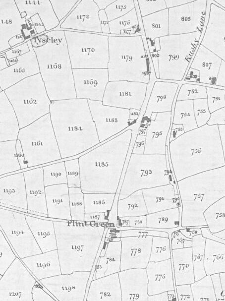
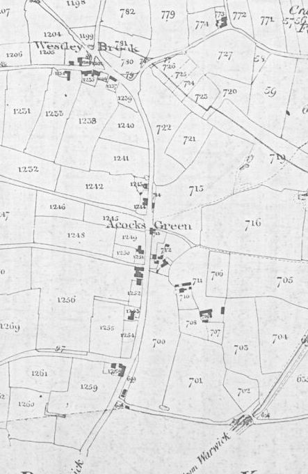
The 1843 Tithe map extracts below show the very small number of buildings. This is an agricultural landscape. By comparing the Tithe Apportionment and directories for the same period we can see that there were farms and several malthouses. There was a malthouse opposite Fox Hollies Road, another at the Green at Shirley Road, and another at Dolphin Lane. Both the Spread Eagle and the Dolphin, either side of the Turnpike tollgate, are there. One shopkeeper is mentioned in the Tithe Apportionment at a location near the Green, William Thomas Jarvis, but the 1845 directory has only James Mullis as a shopkeeper. However, Jarvis is in an 1855 directory. The blacksmith, Samuel Harris, is in the 1845 directory, and the location is opposite Stockfield Road, but no blacksmith is there in the Apportionment, although two shops are mentioned. At the junction with Flint Green Road, there is a half-timbered cottage on the north side, and opposite is the house The Firs, which has some fields nearby. Some agricultural buildings are on the north side across Flint Green Road, and there is a row of Yardley Great Trust charity cottages a little further along. Opposite the Dolphin is a group of buildings. At the back is Acocks Green House, but nearer the road there is a group of cottages, owned separately. The malthouse and other buildings at Dolphin Lane are next to a house with a Georgian façade, later known as Ye Olde House. On the south side there are three more Parish cottages and then the farm at the corner of Gospel Lane (Beech Lane). Finally there is a group of cottages on the north side just before the Parish boundary. Perhaps the most surprising thing is that today’s Green appears to be insignificant, with just one shop.
The 1851 census has a paperhanger’s family on the north side, including two servants, listed west of Flint Green. At or east of the Green on the south side is a shoemaker. There may be one new house between here and the Spread Eagle, as a retired draper is mentioned, or he could be in one of the cottages at the Green. The group of cottages in front of Acocks Green House has become a small farm called Ann Aston. An 1855 directory adds a tailor, and an 1858 directory adds a butcher, a sergeant of police and one definite new house on the north side east of Station Road (Caxton Cottage). After this, directories and the 1861 census show around twenty new houses occupied by businessmen etc. It also has a private ladies’ boarding school near the Green possibly on the north side of the road. The school was later listed on Station Road. The stage was set for full suburban growth.
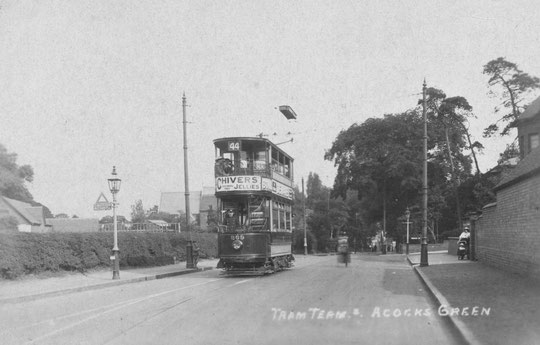
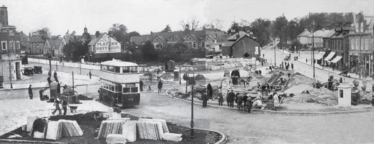
As the population increased, there was a proposal before World War One to brings trams into the centre of Acocks Green. A housholder near the church objected for legal reasons concerning the implementation of the 1912 Tramways Act, and as a result the single track stopped at Broad Road. In 1922 the Corporation overcame this obstacle, and trams came to the Green in 1922. A new terminus was made in 1932. Meanwhile plans lasting a decade were brought to bear on the Warwick Road going east from the Green. Most of it to the top of the hill going down to Olton was widened. This work was reversed in 2015, resulting in wide pavements, slower traffic speeds, and a more pedestrian-friendly ambience with planters, trees and benches. In 2013 Acocks Green Neighbourhood Forum and Acocks Green in Bloom had completed a community orchard at Mallard Close, and by 2016 had created a community garden on both sides of Woodcock Lane. The shops side was on Council land, and the work on the other side was done with the co-operation of the owner of 1220. Both the orchard and the garden add considerably to the enhancement of the road. In 2017 a Heritage Trail was launched, with five of its eight boards being located along the Warwick Road.
In May 2017 the Green itself was enhanced with the installation of a metal sculpture of a stylised tree celebrating Acocks Green in Bloom. It was designed by Veronica Treadwell of Bloom and manufactured by W.R. and J. Collins Ltd at their Hall Green site.
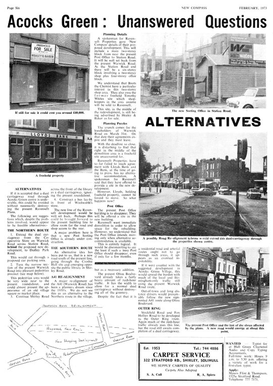
In the 1970s, old shops from the Green to Station Road were replaced. This resulted in some articles in a local newspaper on issues which still have resonance (see below).
We will look at the north side first, in two sections, then the south side, again in two sections:


The National Library of Scotland website has 25-inch maps up to the 1930s, and 1:1250 and 1:2500 maps up until 1973. There is also an option to compare Edwardian and current maps of various kinds using a slider. For this use the geo-referenced maps option. This is useful for plotting the exact location of changes.
The history of the Warwick Road in Acocks Green
North side of the Warwick Road, Stockfield Road to Station Road
North side of the Warwick Road, Station Road to Lincoln Road
South side of the Warwick Road, opposite Stockfield Road to Westley Road
South side of the Warwick Road, Shirley Road to Olton Boulevard East